Xizhi, New Taipei City
Dream Lake/Xin Mountain Ridge/Ruyi Lake/Kezilin Mountain Ridge Hike
The hike starts at Dream Lake, climbs to the top of Xin Mountain, then climbs over knife-edge ridges with great views, with a possible extension to Ruyi Lake and Kezilin Mountain ridge.
Access: take the train to Xizhi Station. Dream Lake (夢湖) is located at the end of a narrow mountain road far from any bus stop. The only way to get there is by taxi from the train station. Expect to pay about $300 for a taxi from the station.
Length: 3km, about 3 hours, add another 1.5 hours for Ruyi Lake
Difficulty Level: 3/5
Trail Conditions: narrow dirt trail with short rope sections, steep climb up to Xin Mountain from the lake
The Hike
This guide starts from Dream Lake, climbs to the top of Xin Mountain, then follows the orange trail going south down from Xin Mountain shown on the trail map.
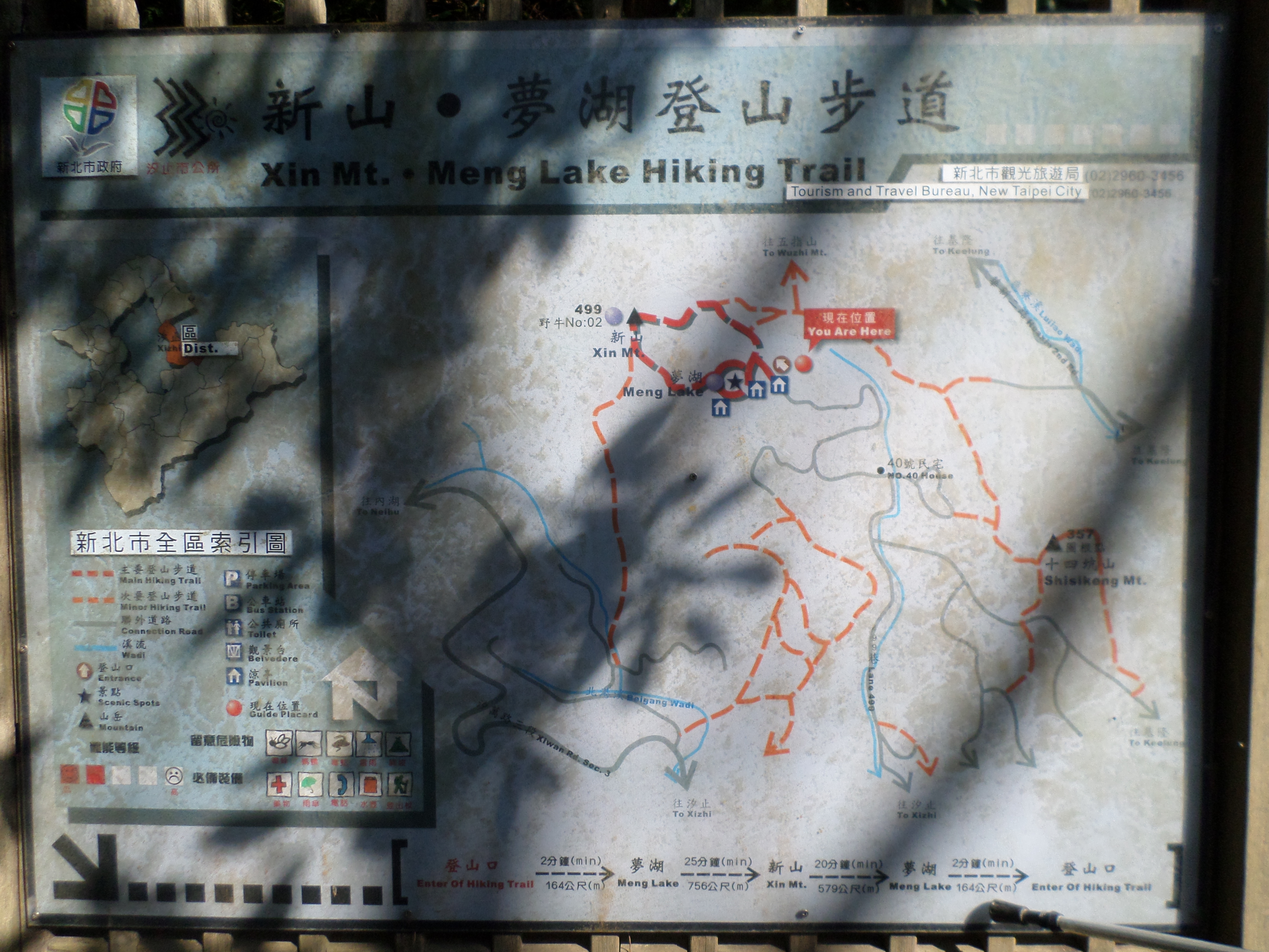
trail map
The lake is located a few minutes walk along a stone trail from the end of the road. There is a dirt trail that goes around the small lake, but it only takes a few minutes to walk around the lake. Other than that, there is a rest area, a dock, and a café that doesn’t seem to be open anymore.
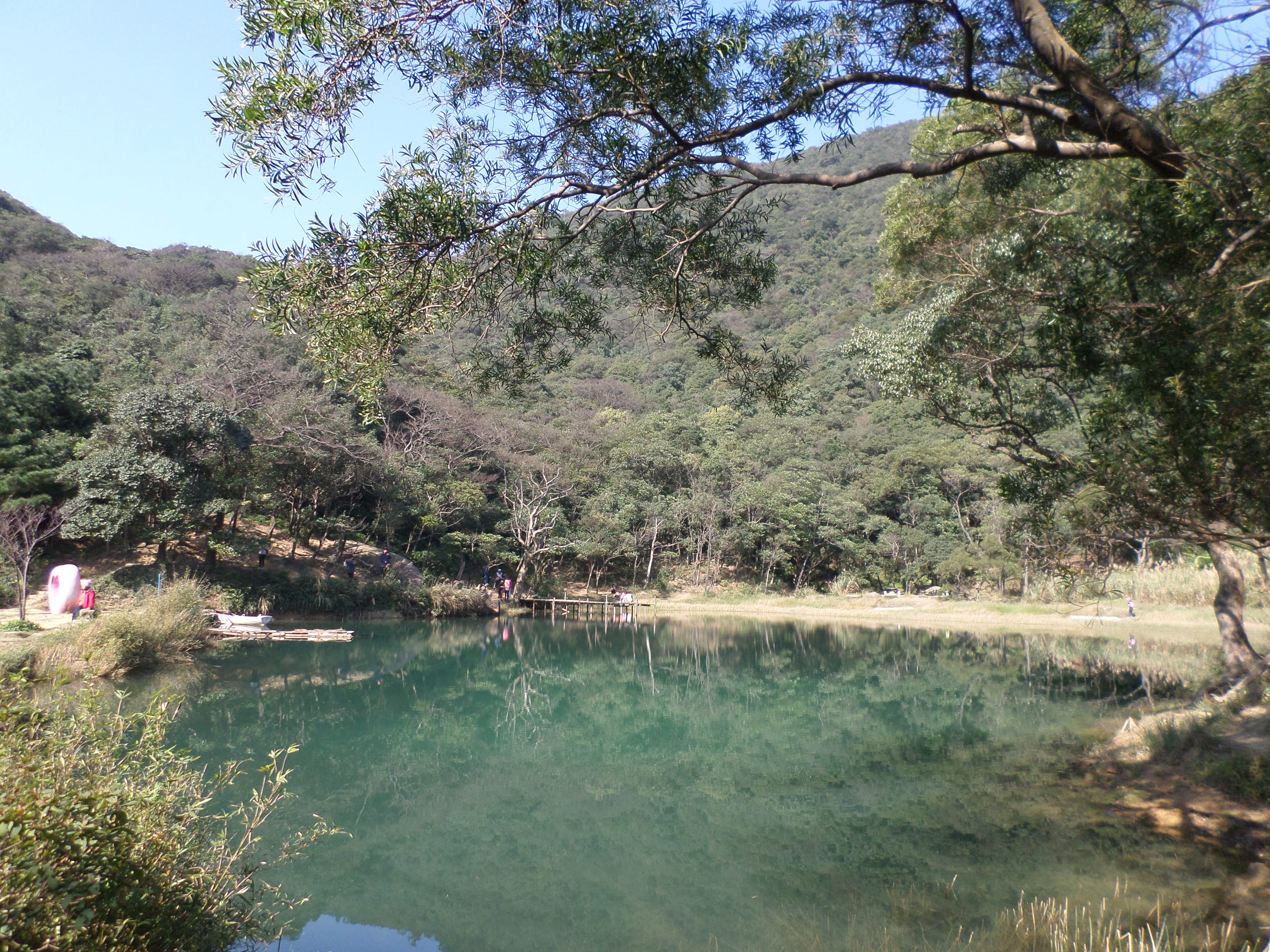
Dream Lake
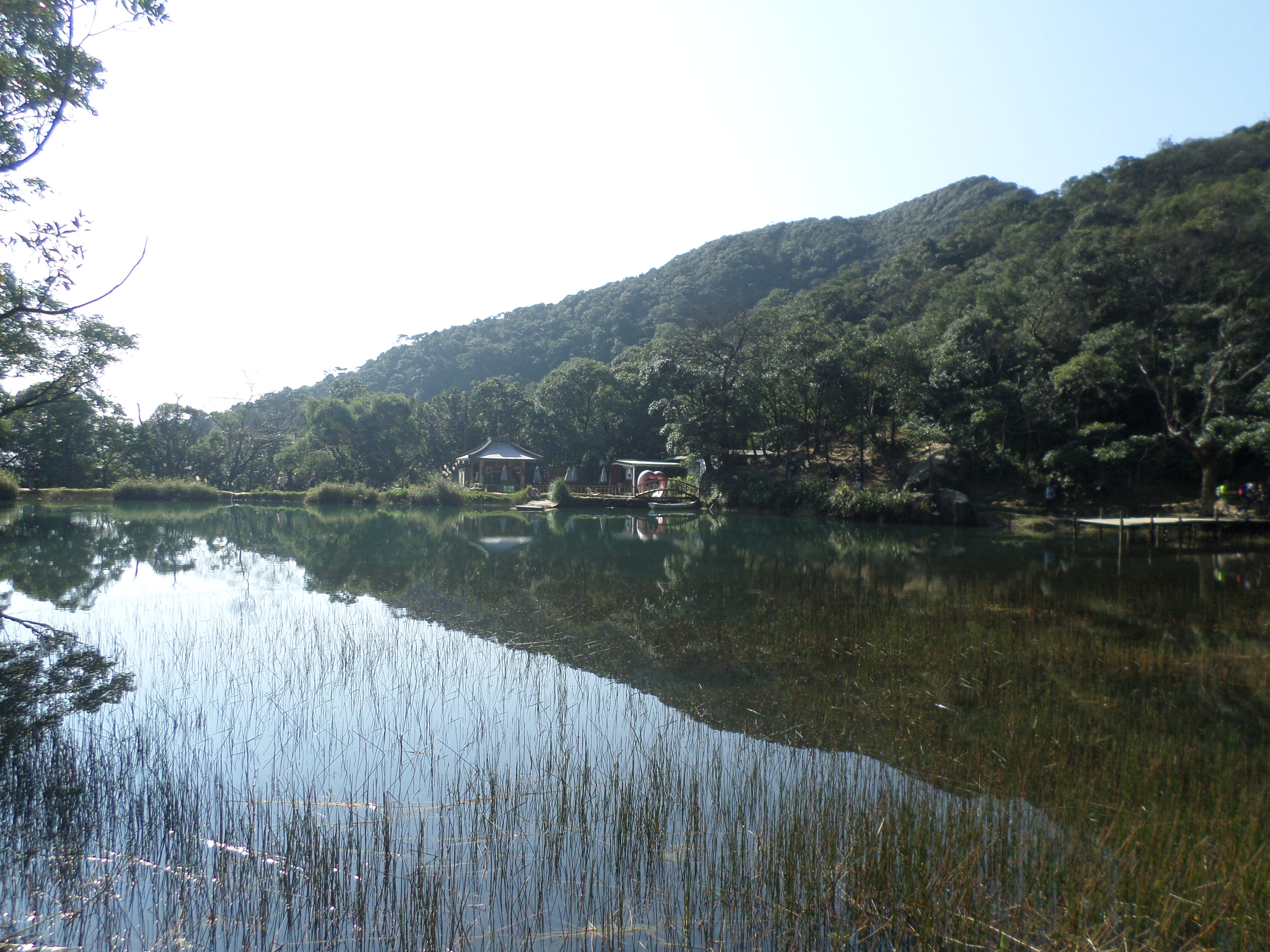
Dream Lake
From the back of the lake, there is a trail leading up to the top of mountain, signposted for Xin Mountain. It is a very steep 20 minute climb to the top. About halfway up there is a rock that you can stand on with great views of Dream Lake below and the surrounding mountains.
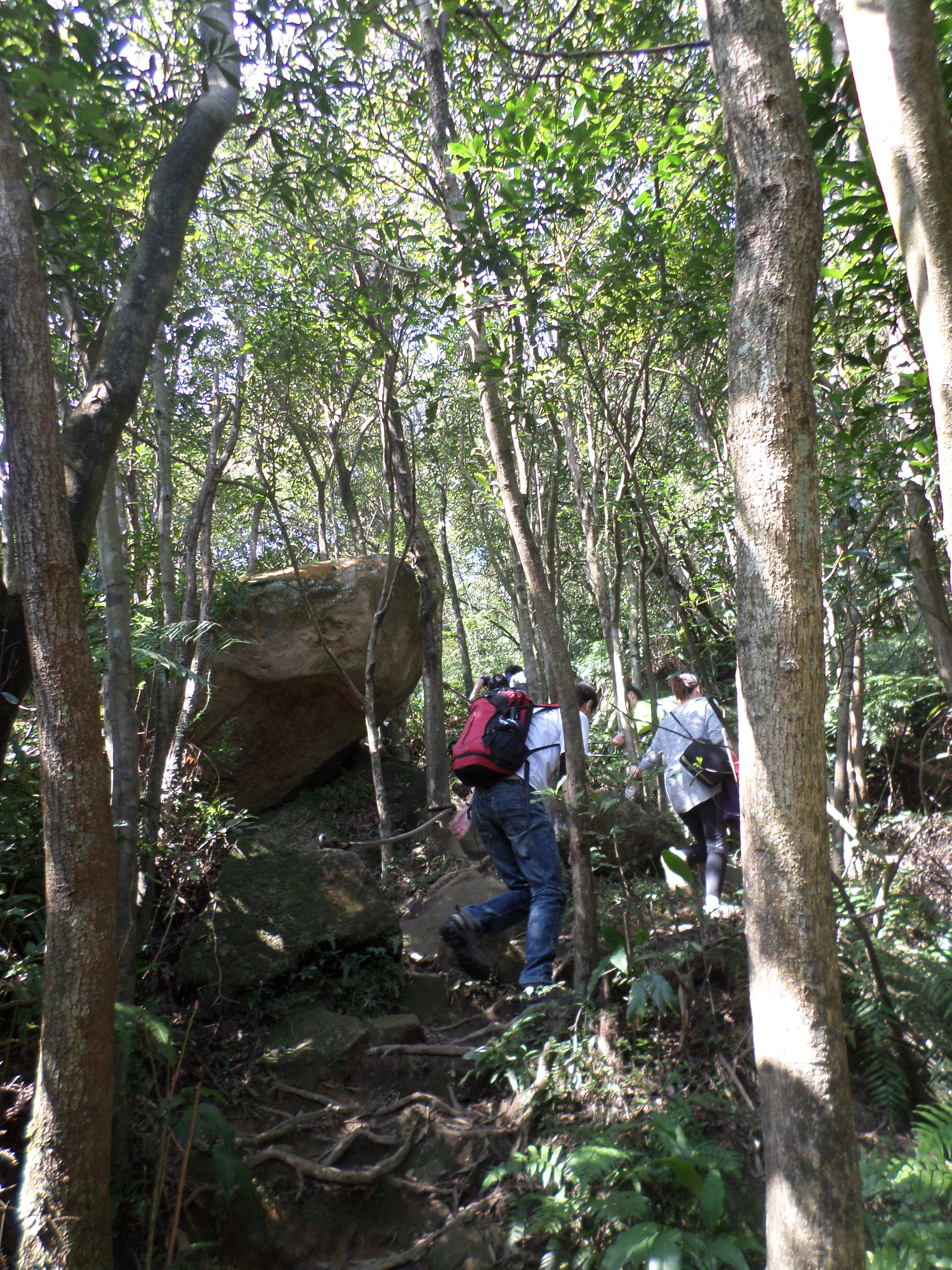
climb up Xin Mountain
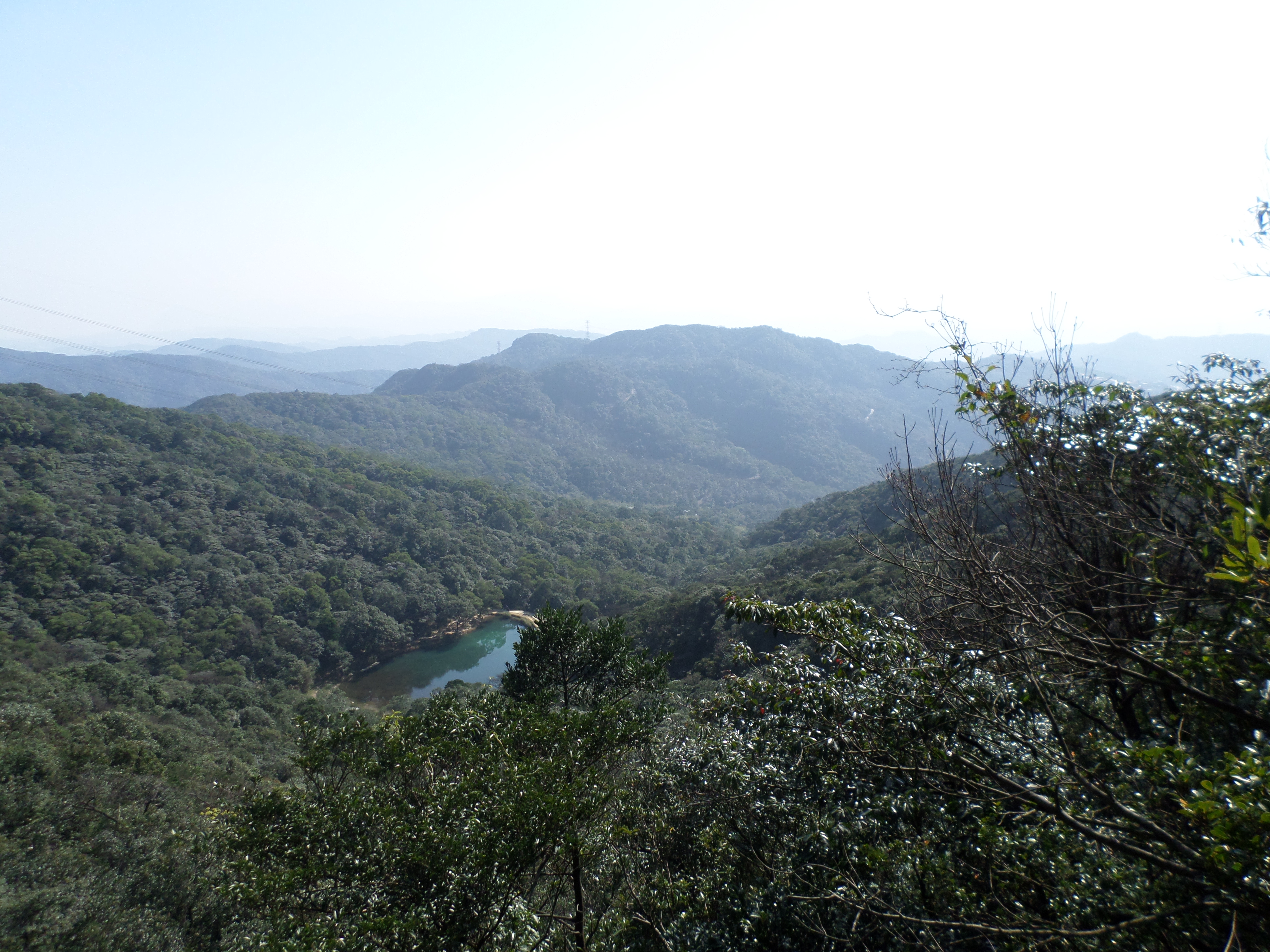
view of Dream Lake
The summit of Xin Mountain offers the first of many knife-edge ridges. It’s a great place to rest after the climb up.
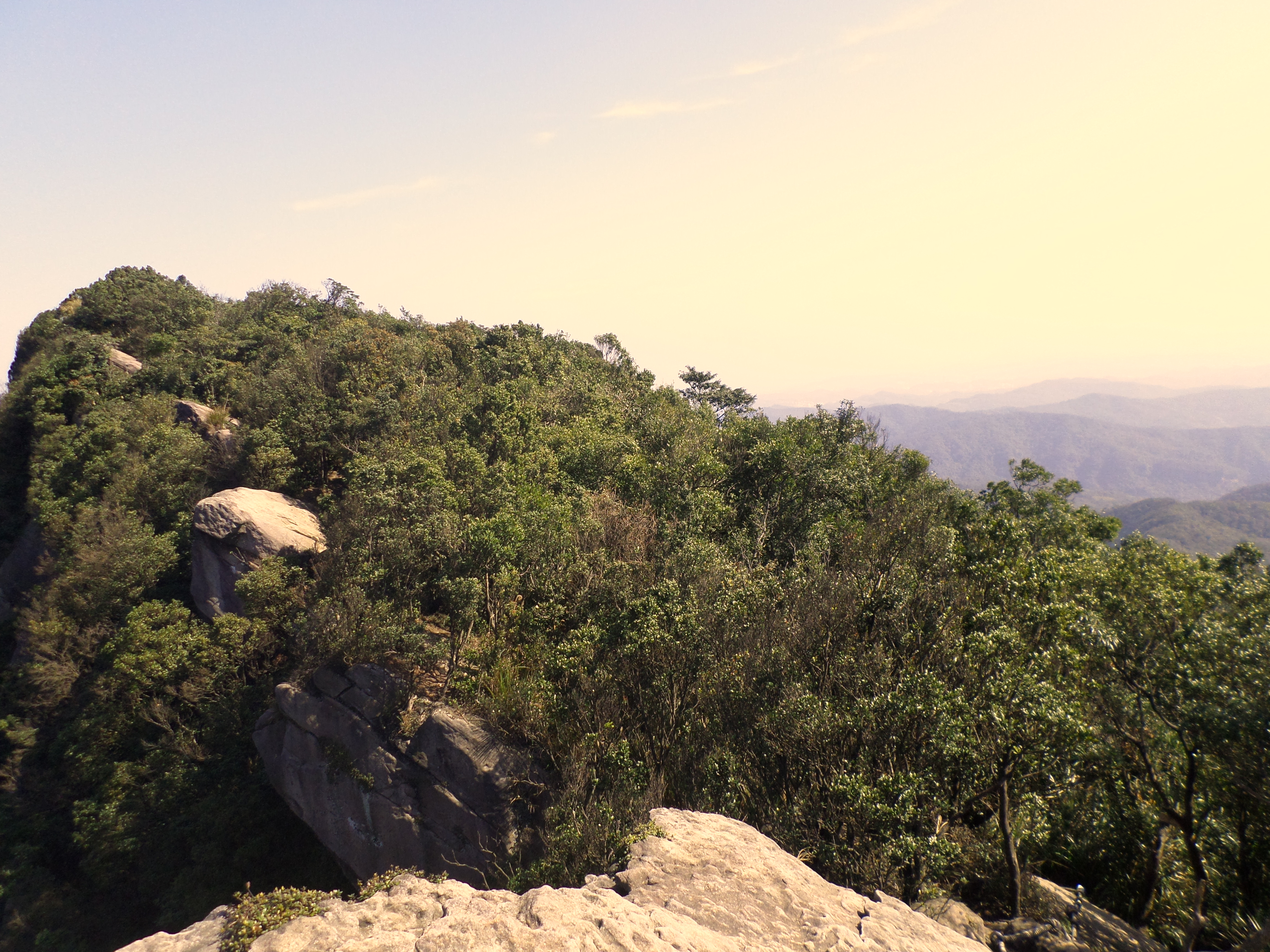
Xin Mountain
Xin Mountain
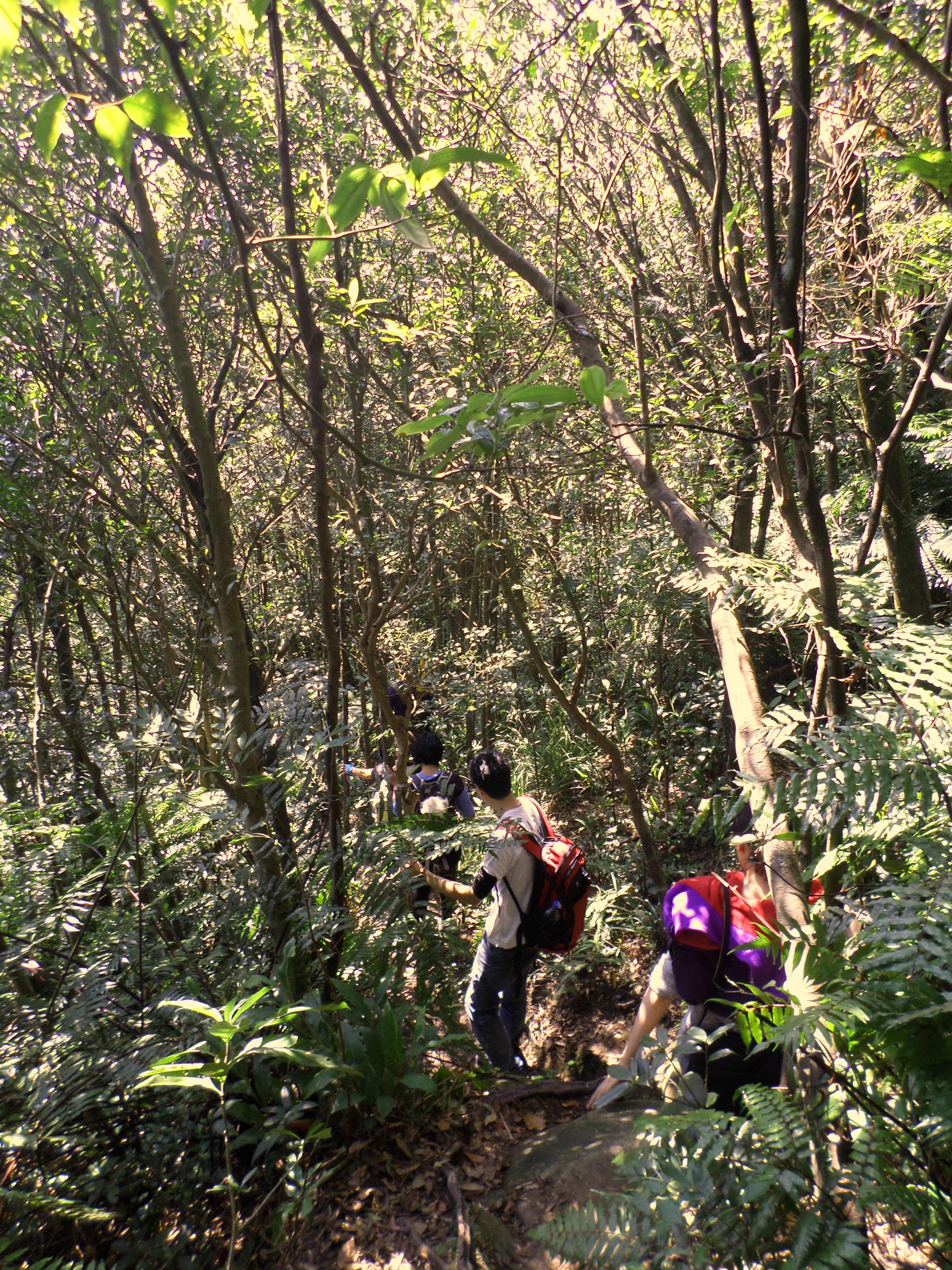
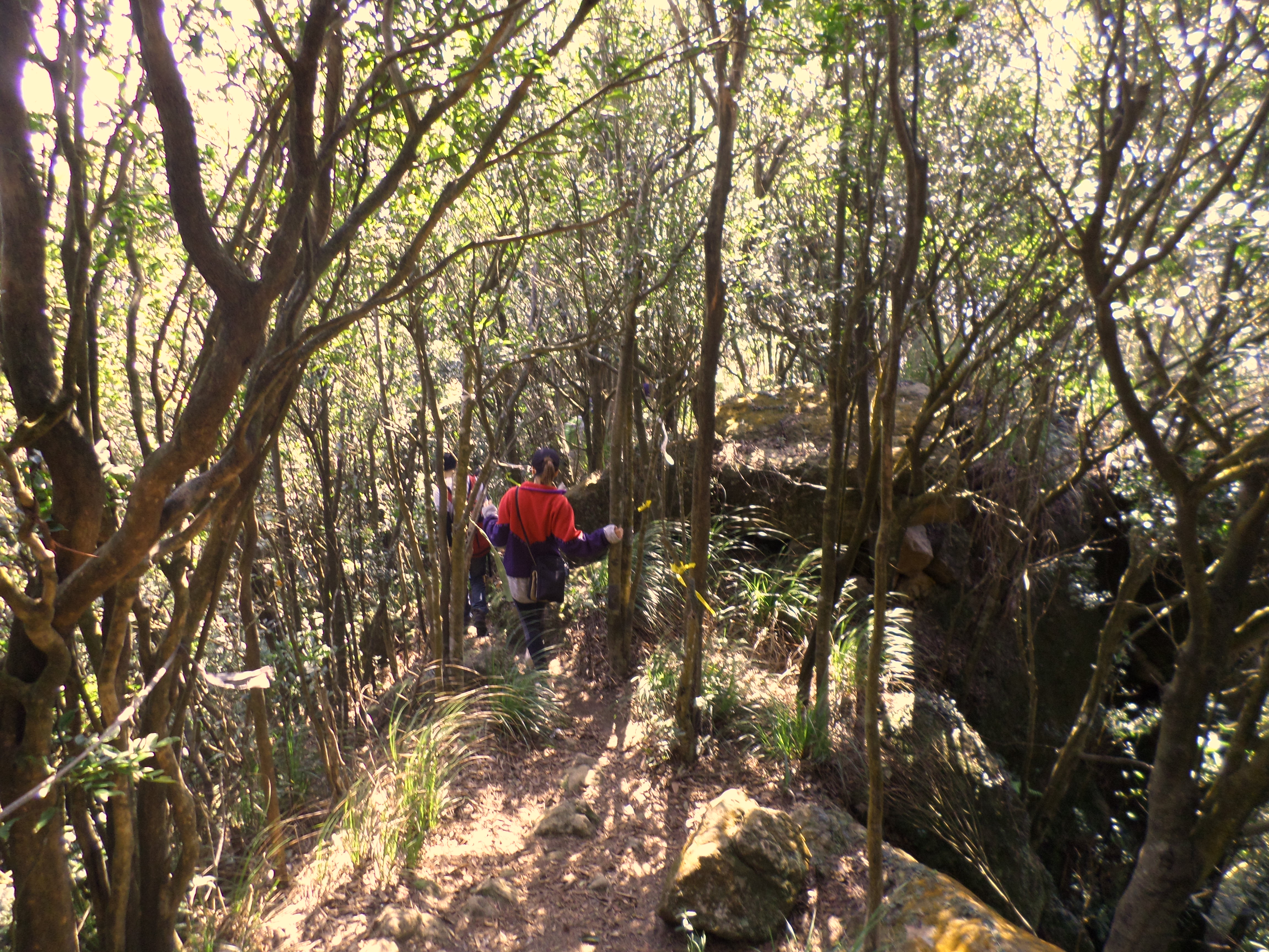
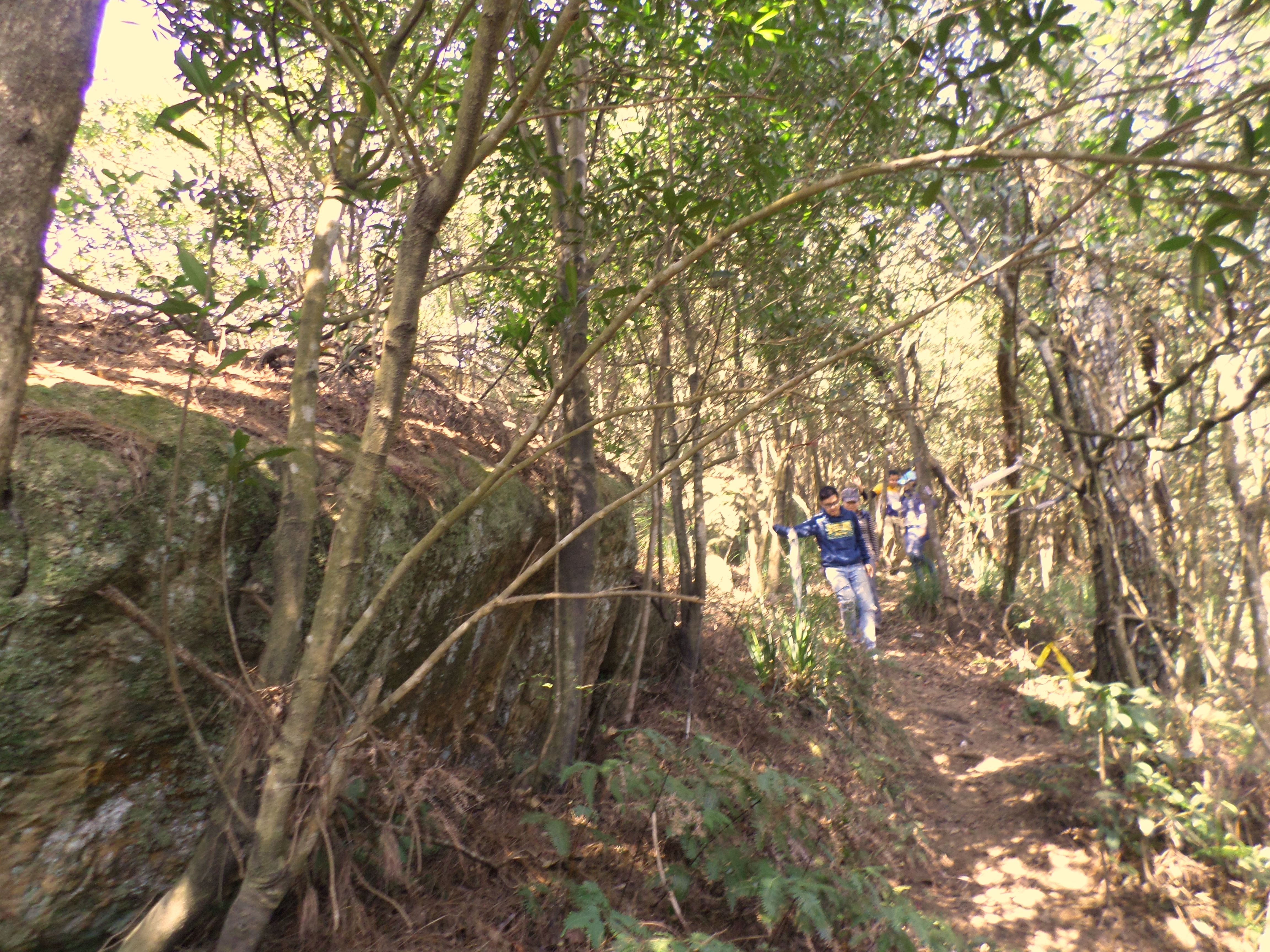
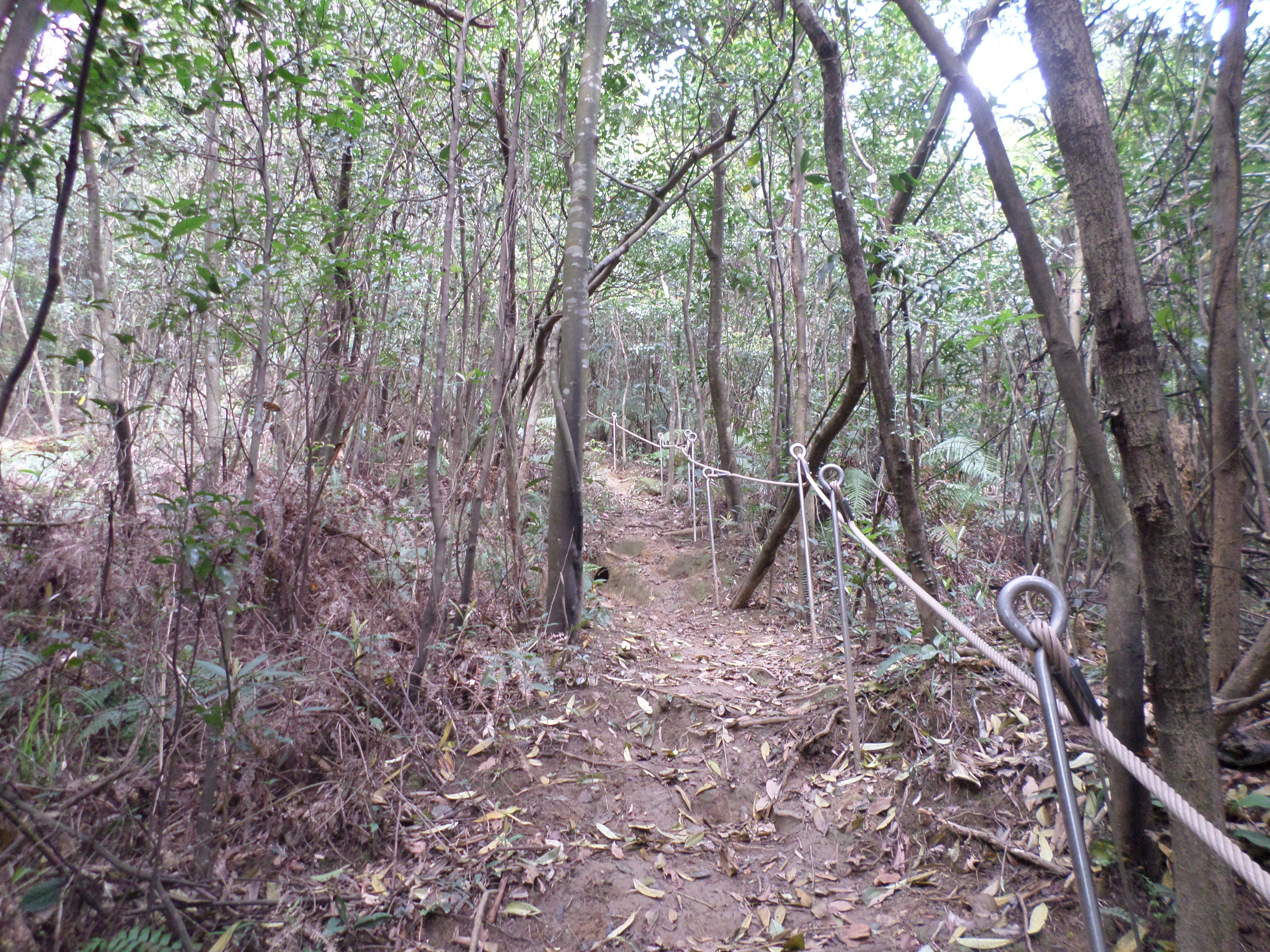
From the summit look for an unmarked trail going down along the ridge. The trail down is narrow and you’ll need to hang on to lots of trees and ropes for support. You’ll soon come to an unmarked trail junction with a sign attached to a tree pointing the way to Happy Farm in Chinese. Take the right fork at the junction, towards Happy Farm. The trail will continue to climb down using ropes before reaching the next exposed ridge.
going down from the peak
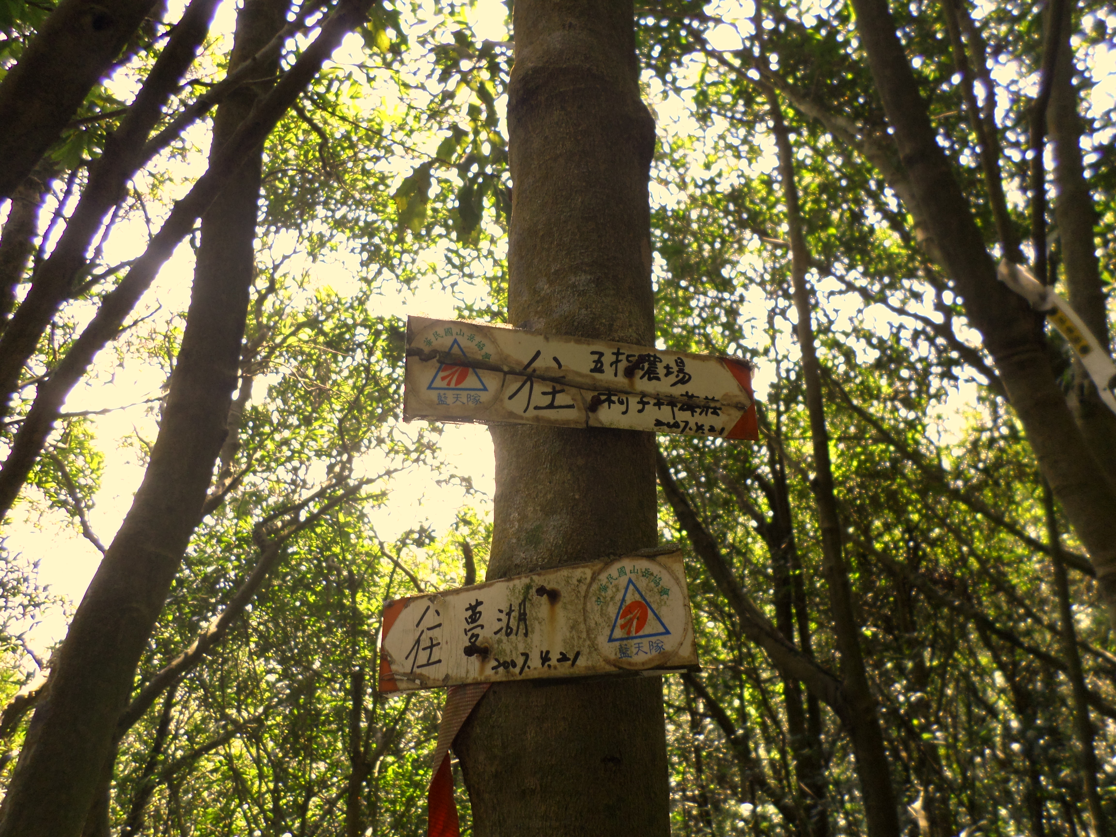
signs at the trail junction, turn right here

more ropes
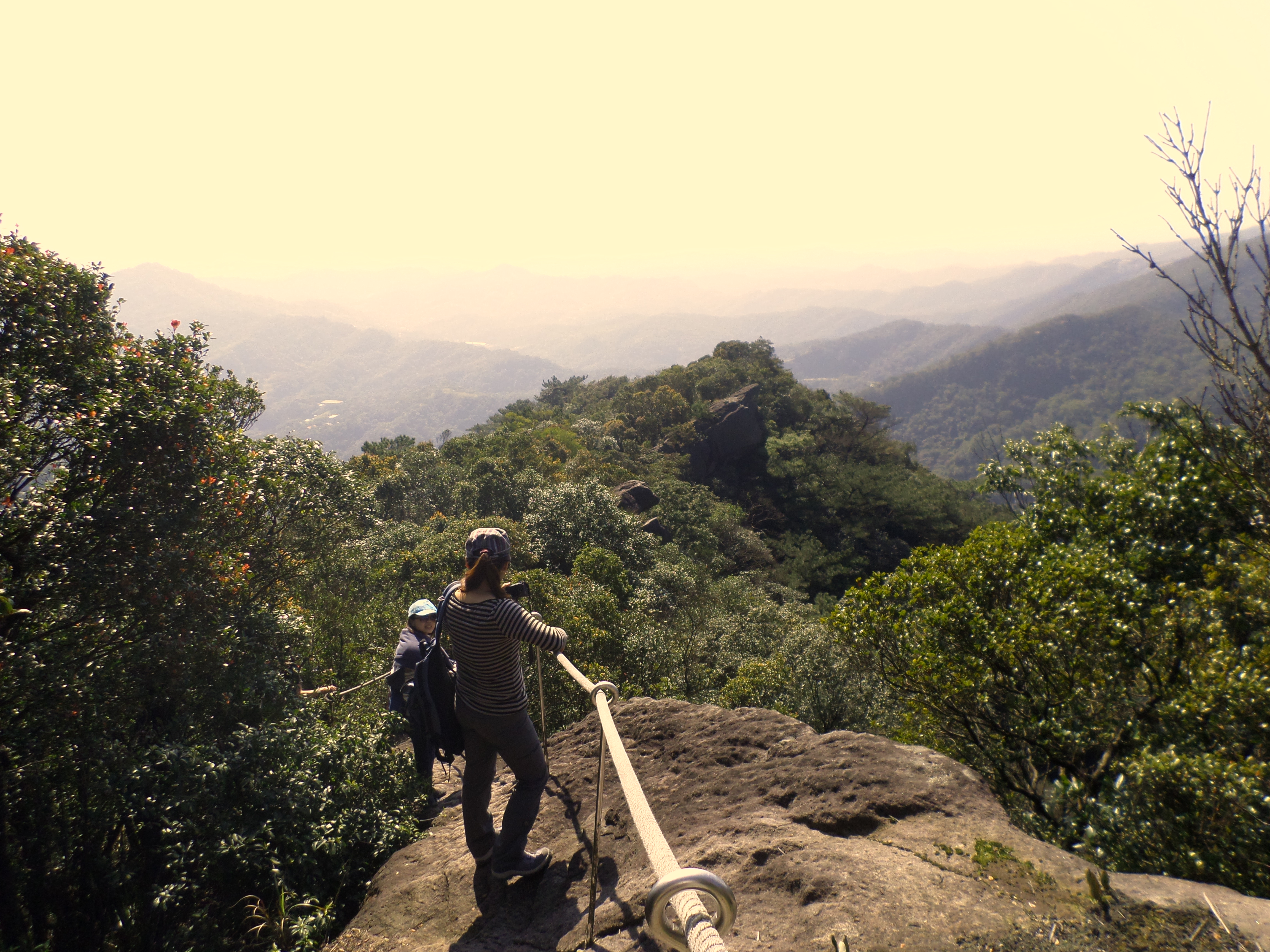
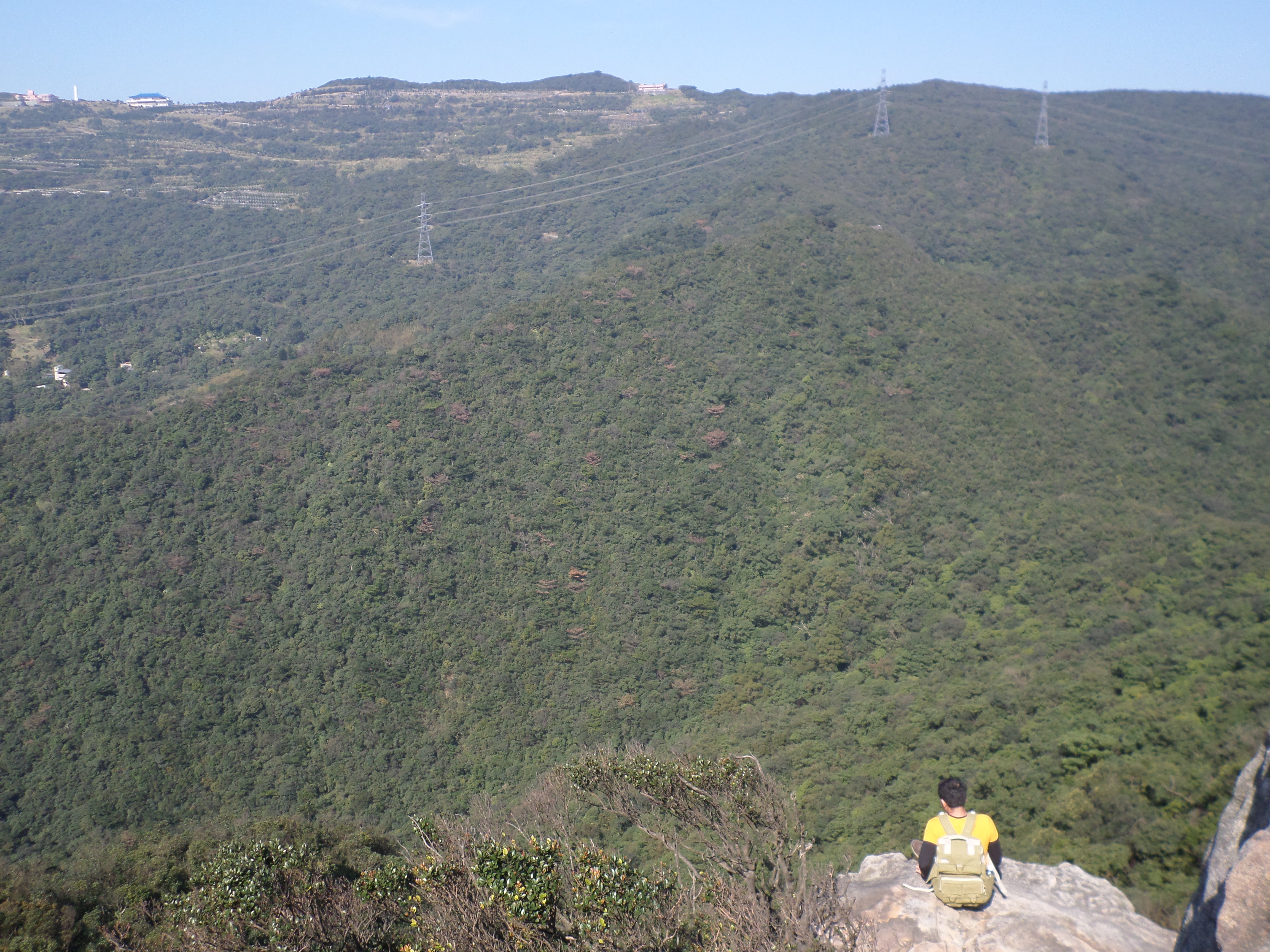
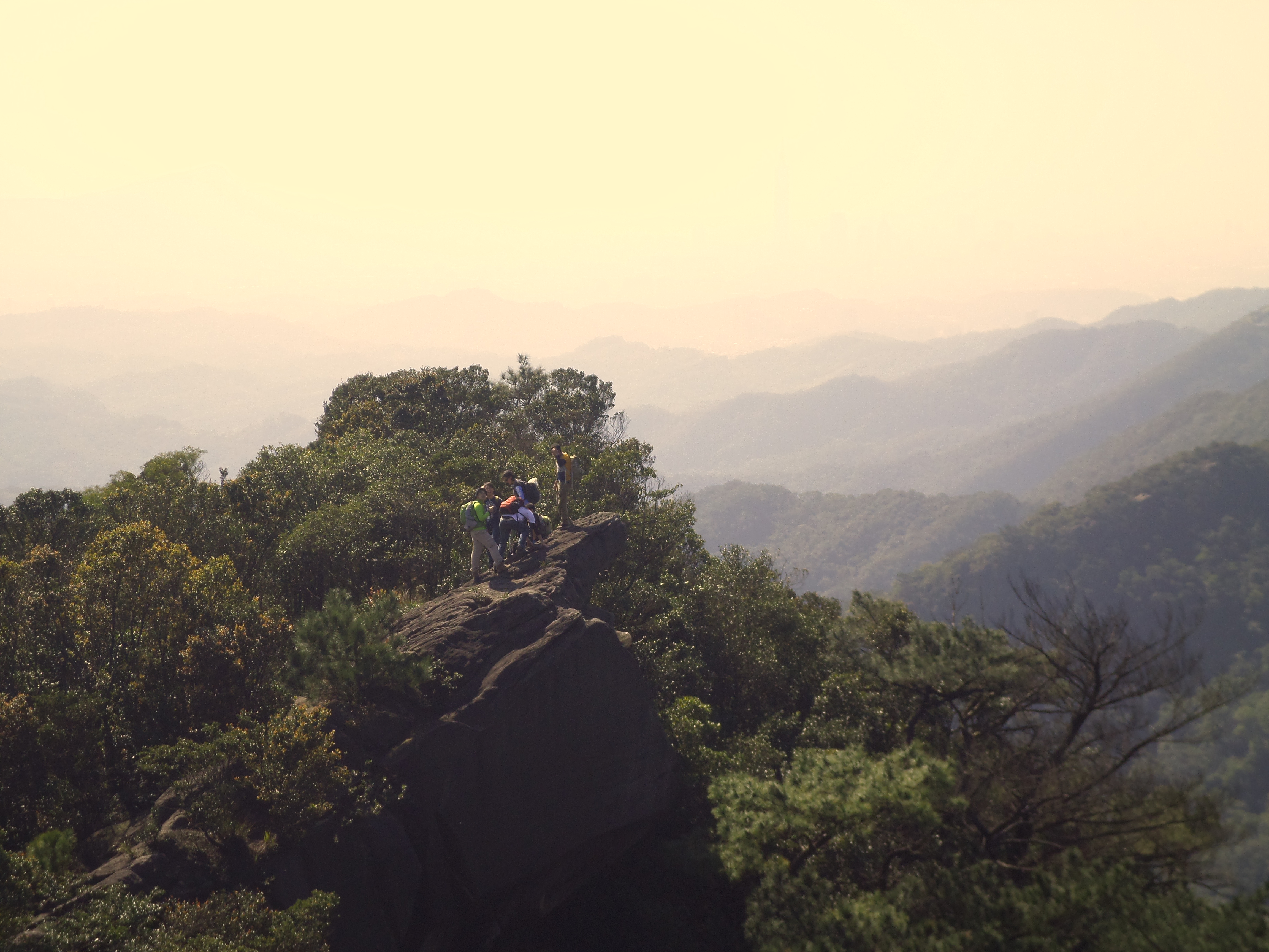
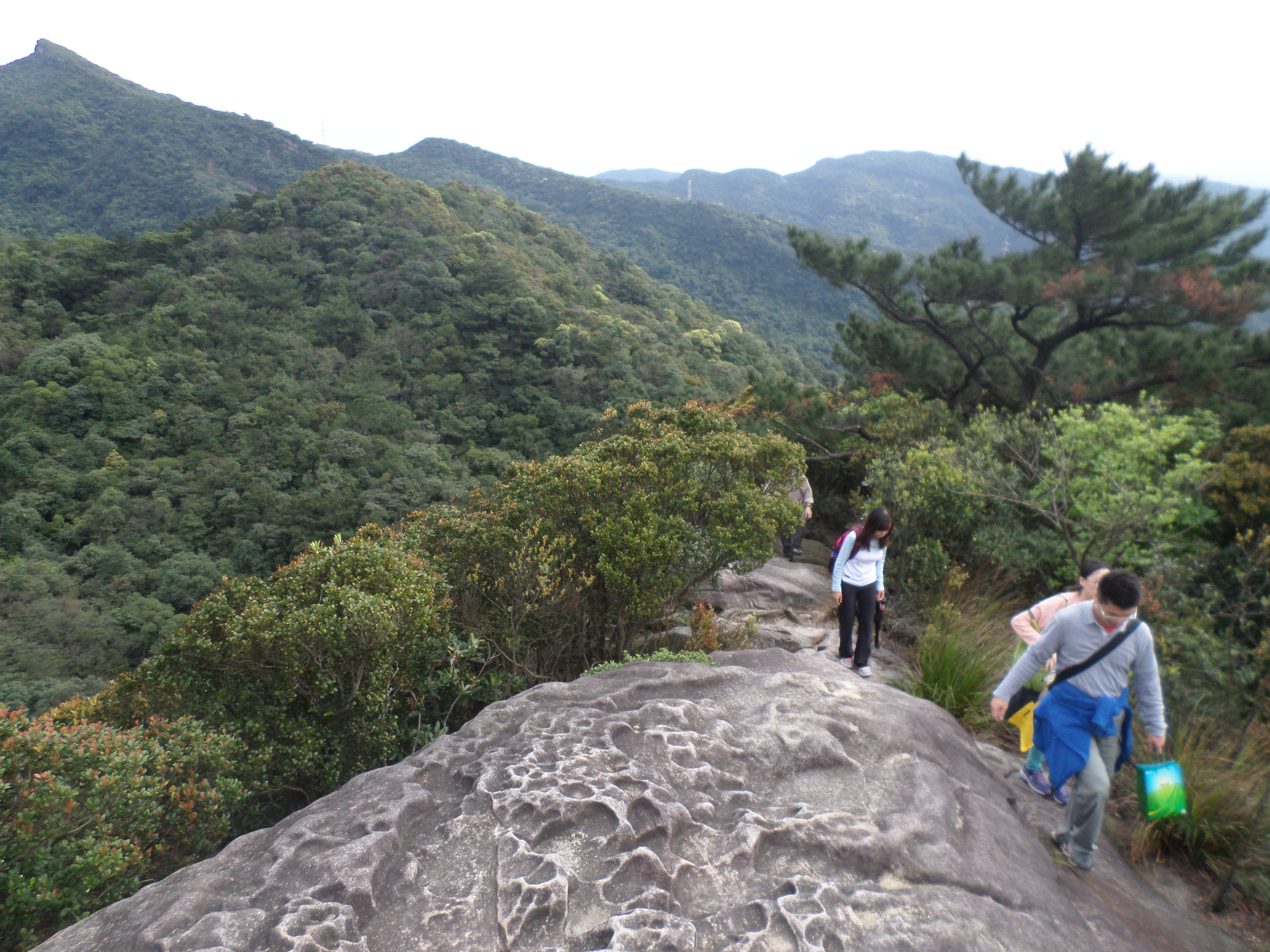
posing for pictures at another exposed ridge
Climb down from here and then back to another exposed ridge on the other side.
down and back up to the next ridge
great views from the ridges
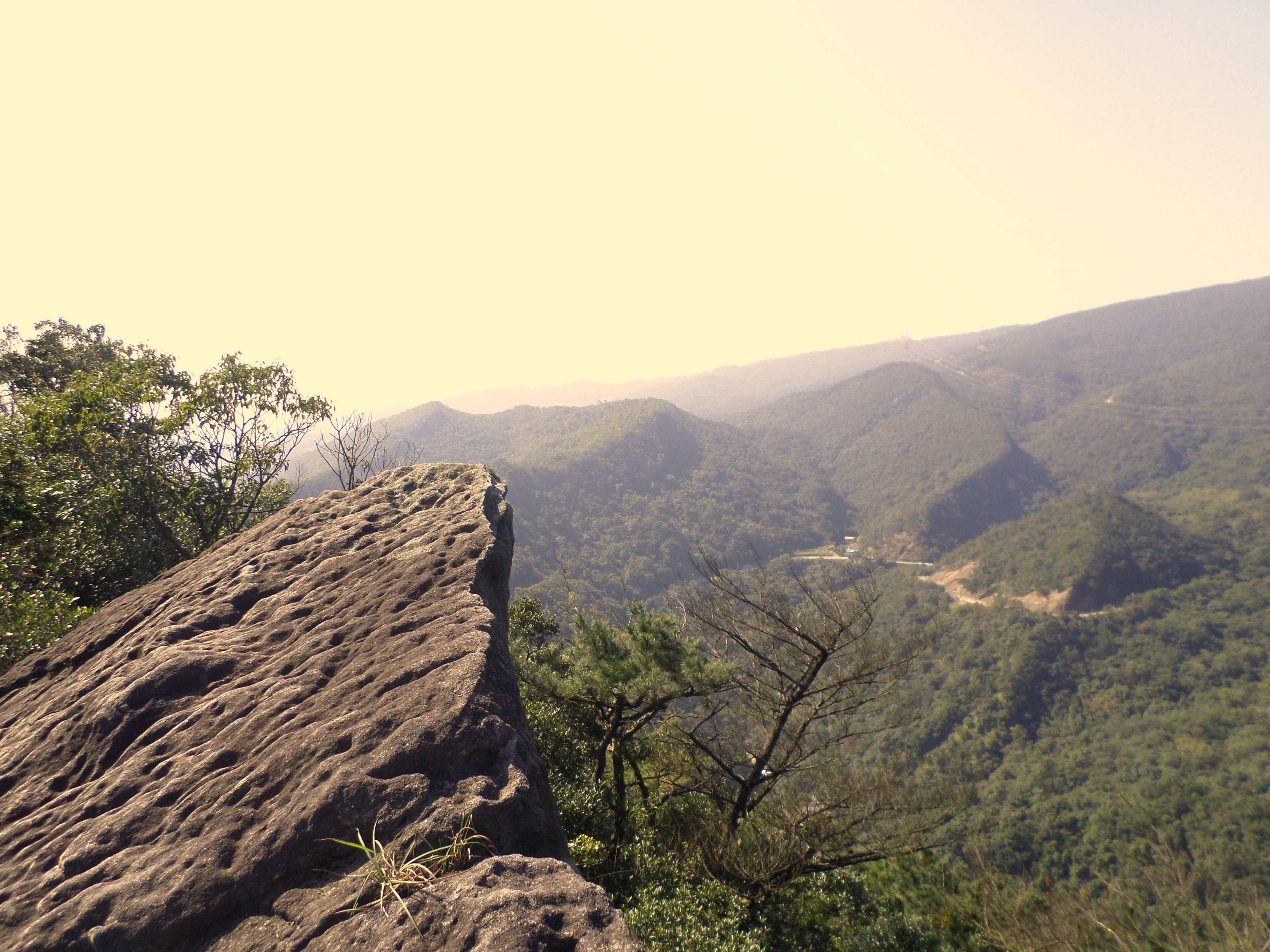
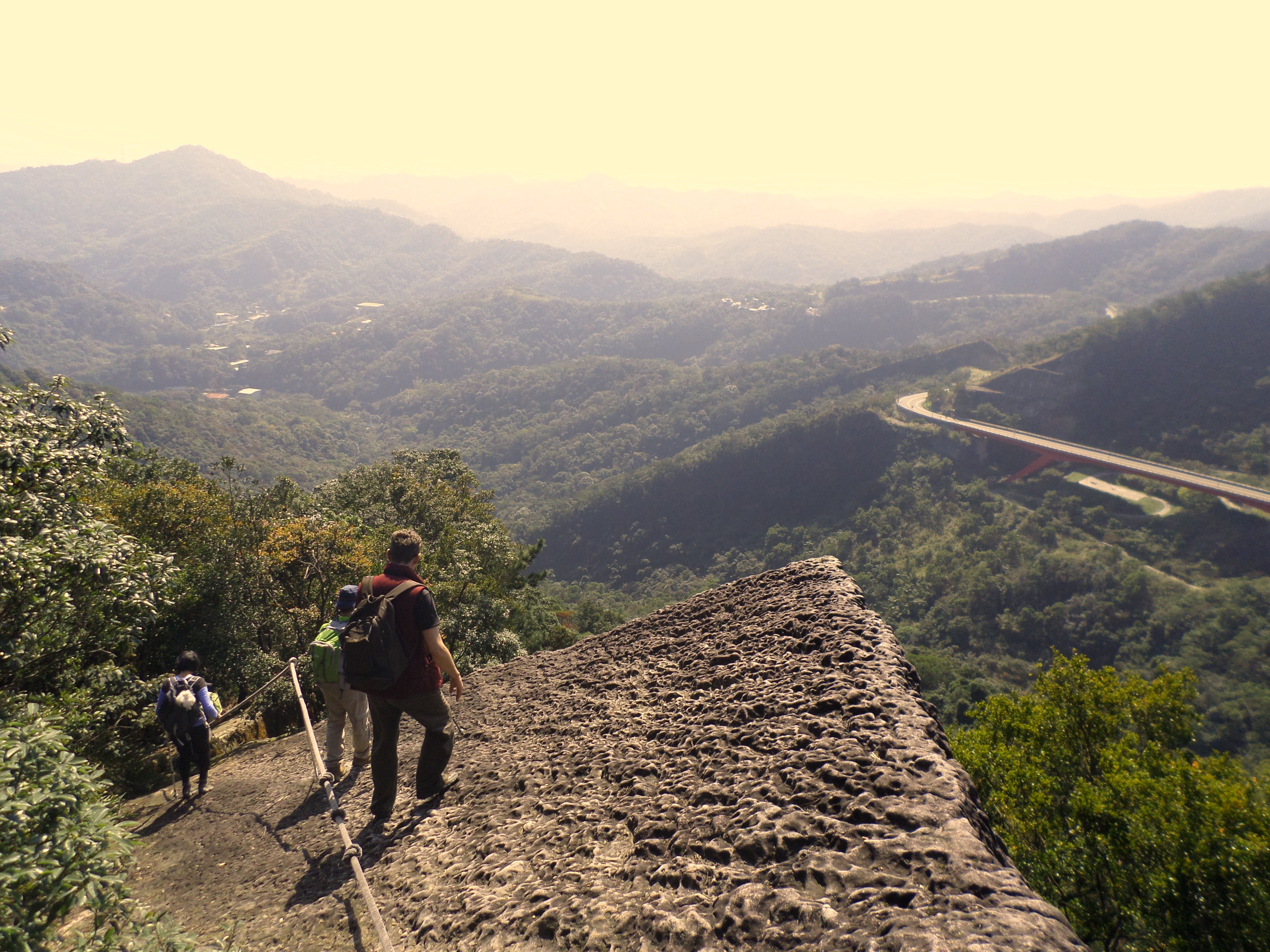
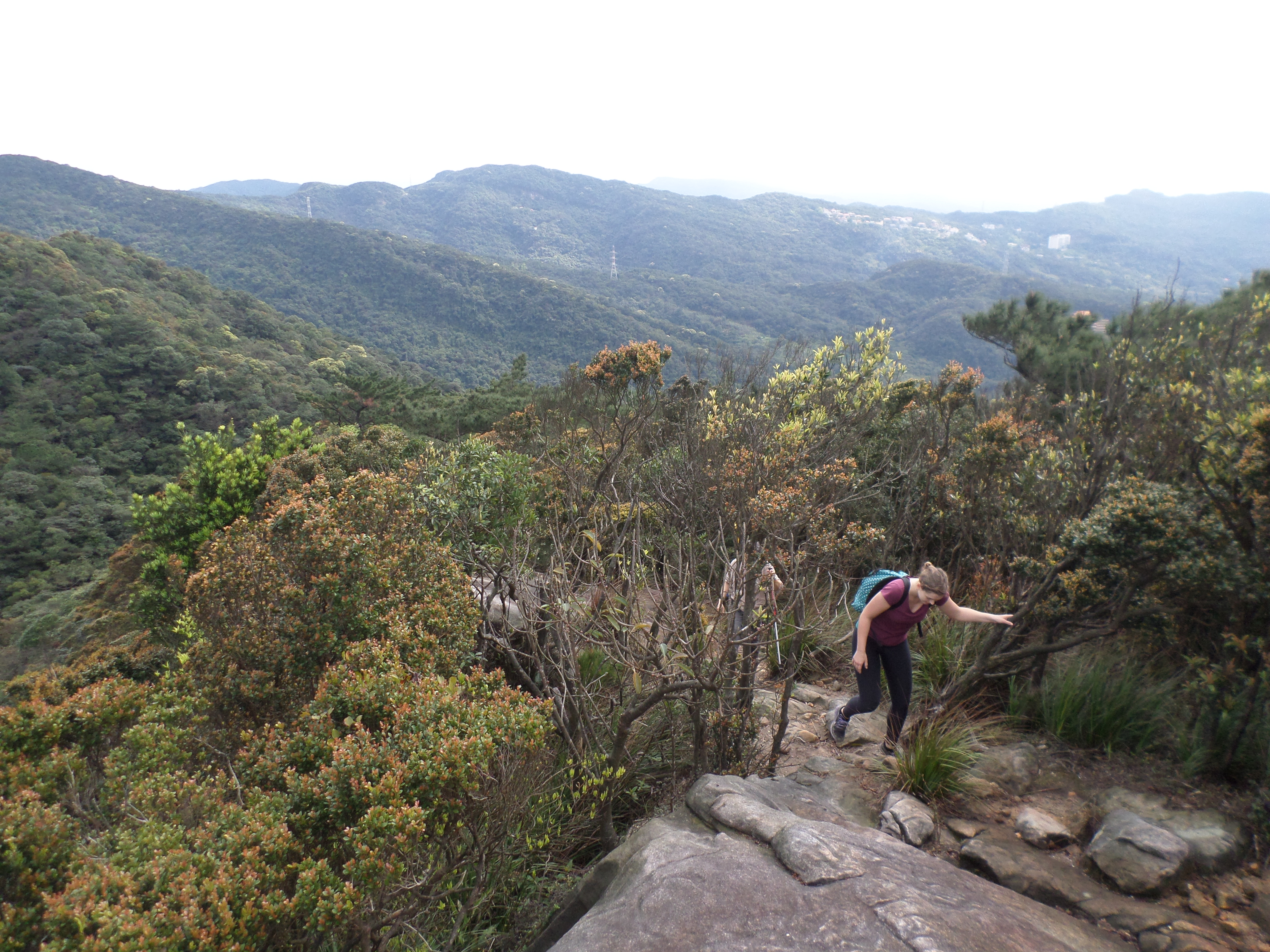
From here the trail continues down through the trees, sometimes emerging on the edge of the cliff with a long drop off below. The trail will emerge onto one more exposed ridge with a view of a highway bridge below.
going down from the exposed ridge

on the edge of the cliff
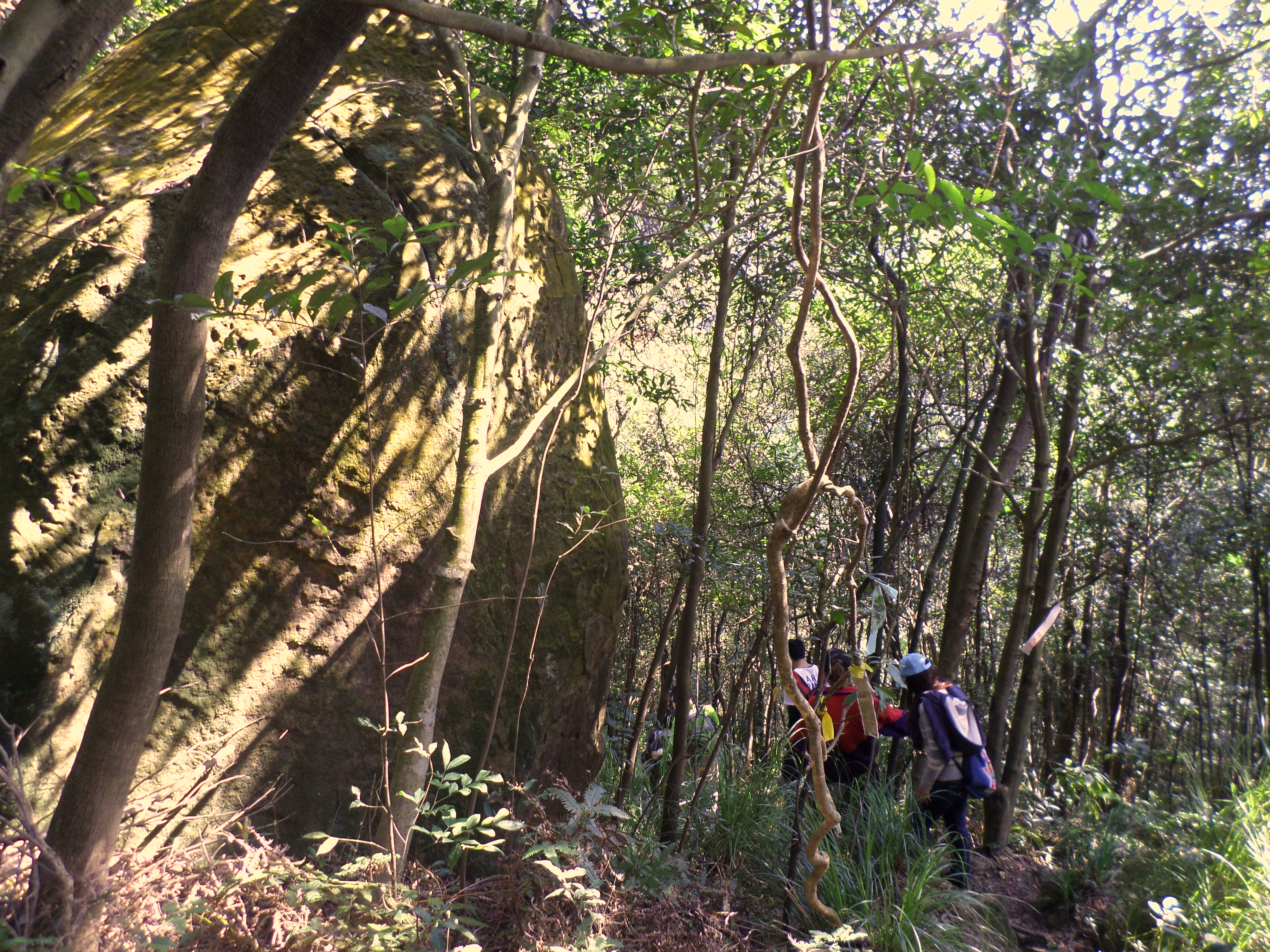
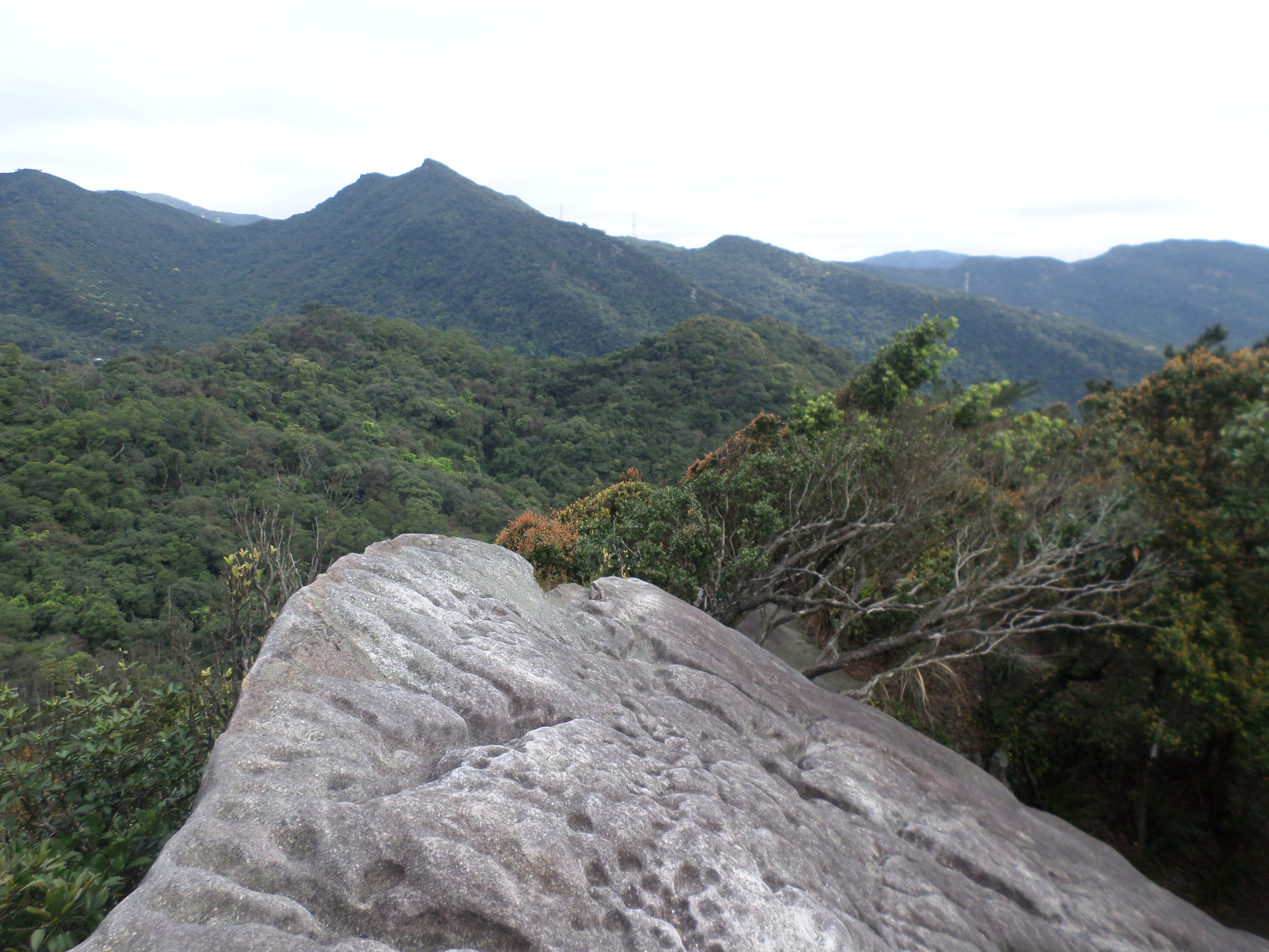
hiking past some boulders
last exposed ridge
After the last ridge, the trail begins its long descent through the trees past some rocky outcrops. At the bottom the trail crosses and small stream then follows it for a short distance. This stream then joins a larger stream. There is a bridgeless crossing to make here. With the aid of ropes and rocks you can cross the stream without getting your feet wet. After the river crossing you’ll soon come to a junction with a larger trail. Turn left here signposted for Kezihlin Chajhuang. The trail will end at a road and a swimming area in the stream.
making the final descent
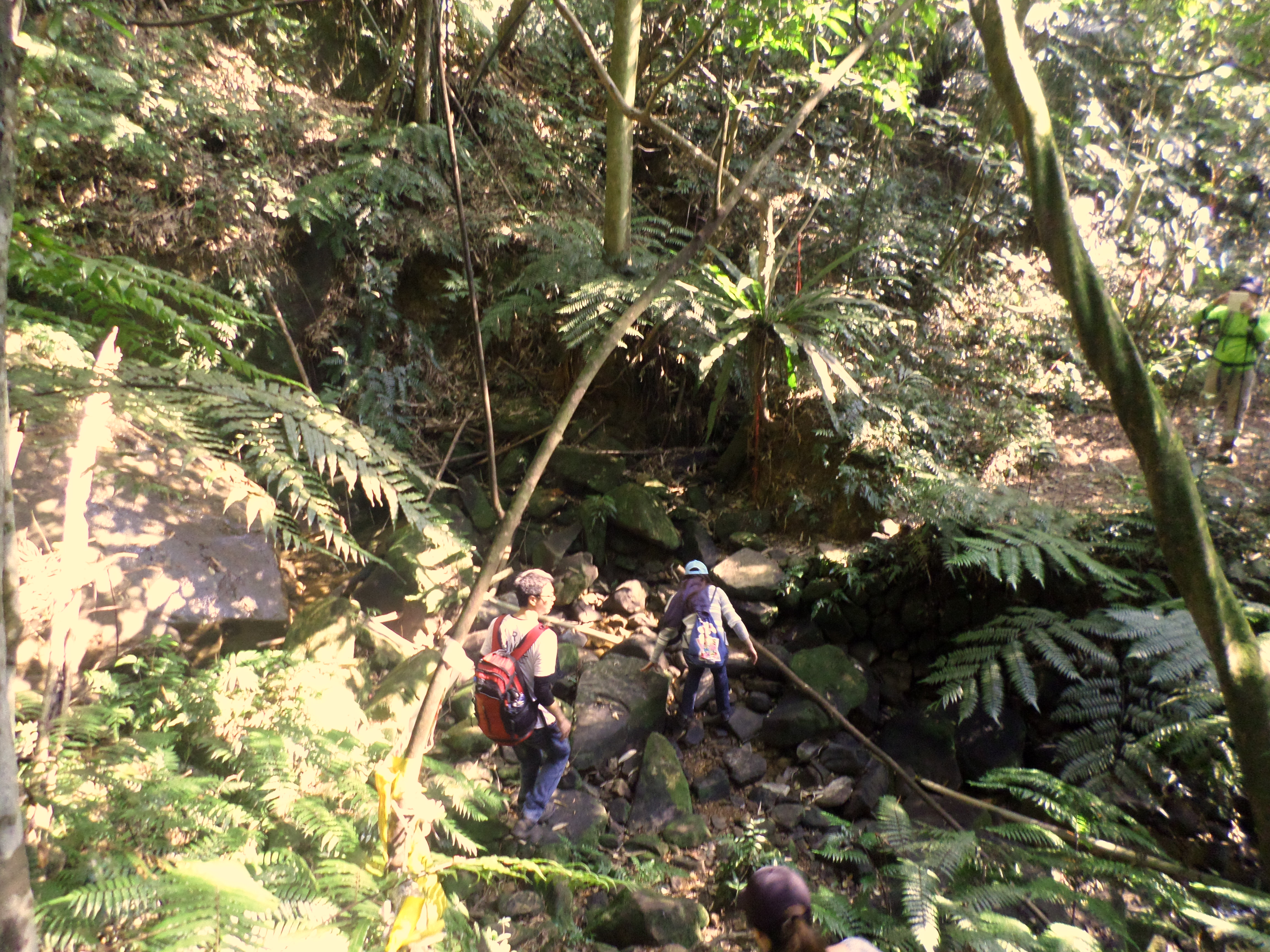
cross the small stream at the bottom
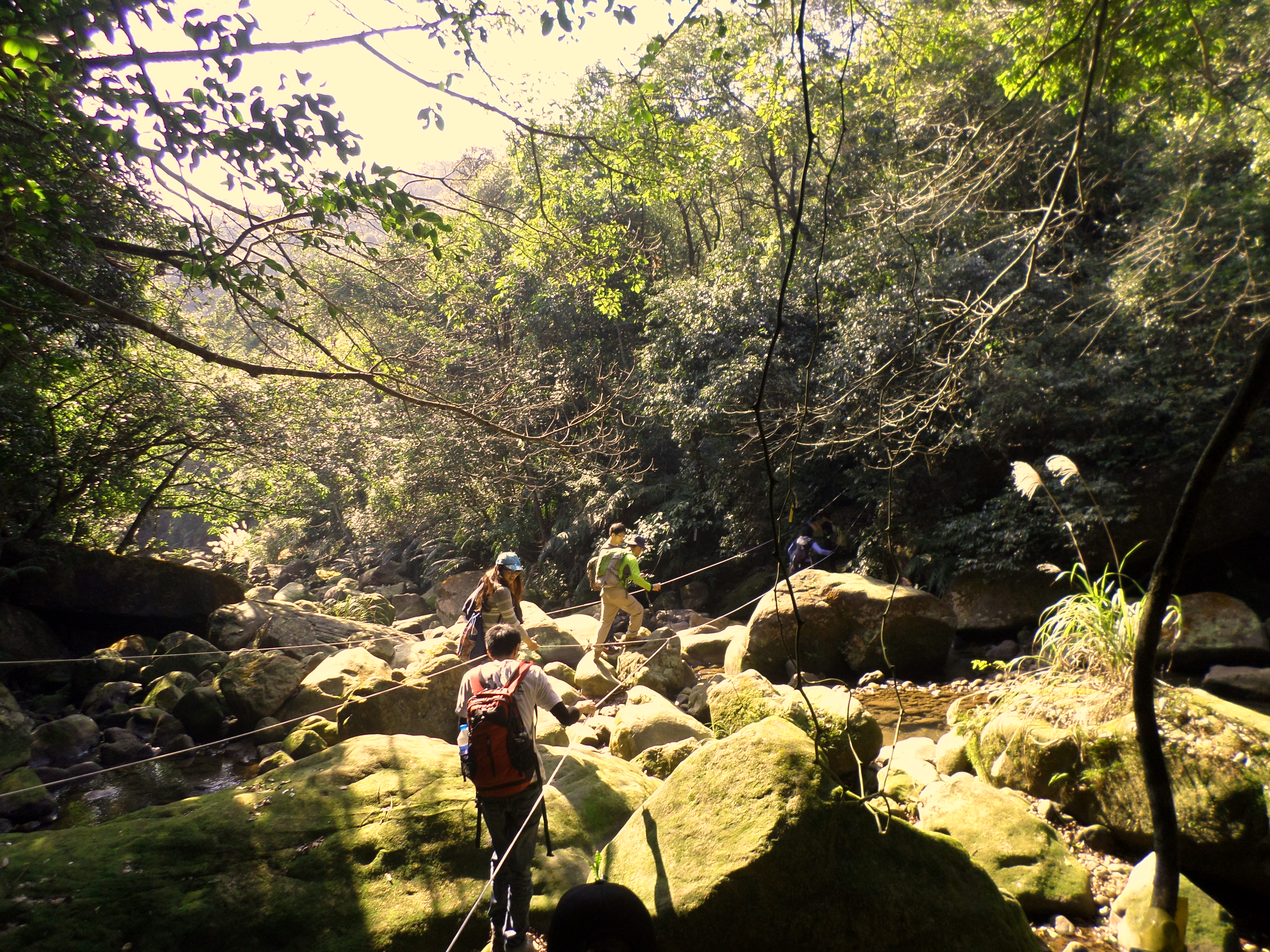
stream crossing using ropes
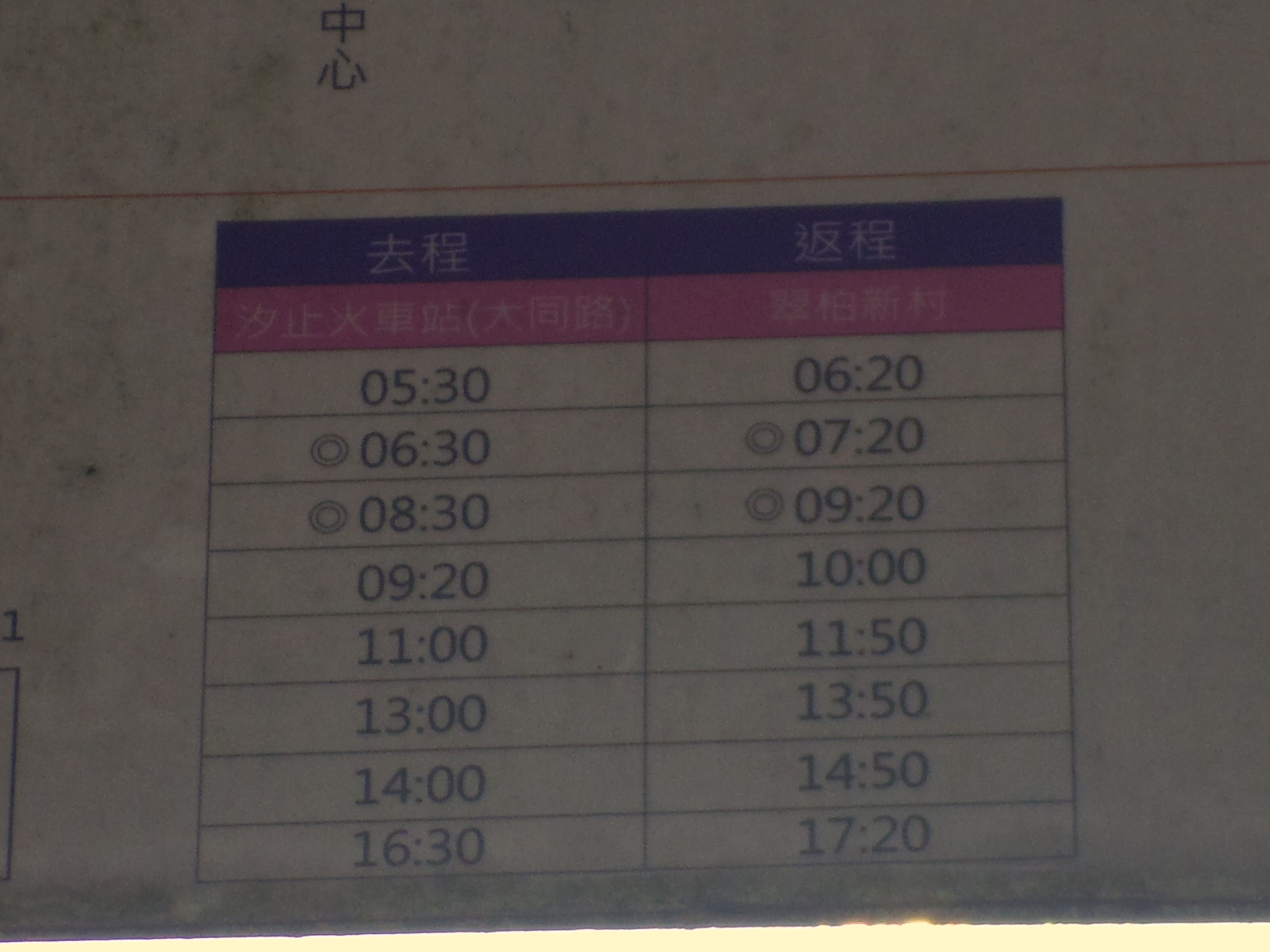
bus schedule
Follow the road around to the main road where you can catch the F910 bus back to Xizhi Station. The times listed in the right column are for the bus going to the station. Note that the times listed are for when the bus begins its route, not for when it reaches this stop. It takes about 20 minutes for the bus to get here from the start of its route. The bus is free. If you have a long time to wait it may be possible to flag down a passing taxi or hitchhike.
To Ruyi Lake
If you have a long time to wait for the bus or want to do a bit more hiking Ruyi Lake is also worth a visit. From the swimming area turn right instead of left and walk to the end of the road. A short trail leads up to the highway. When you reach the highway, turn right a walk along the road for a short distance until you come to a trail starting on the left hand side which is clearly marked with a sign and trail map.

start of the trail to Ruyi Lake
From the road the trail climbs steeply and reaches the lake in about 5 to 10 minutes.
climbing towards the lake
At a trail junction turn right signposted for Ruyi Lake. The trail drops down to reach the lake in a couple of minutes.

Riyu Lake
From the lake return back to the trail junction and keep climbing. The trail climbs up Kezilin Mountain which has more exposed ridges.
climbing Kezilin Mountain
climbing Kezilin Mountain
at the top of the ridge
There are many trails around the area, but the trail map at the start of the hike is not accurate. From the top of Kezilin Mountain ridge there are no more signs making it hard to know where the trails are going. Also, the trails beyond the ridge are not frequently hiked and so are covered with spider webs. From the top of the ridge it is best to return to the road and walk downhill to the bus stop.
Map of the Hike

Pingback: xin shan to meng hu and kezilin river pool (新山, 夢湖, 柯子林天然游泳池) | taiwan trails and tales
Pingback: xin shan to meng hu and kezilin river pool (新山, 夢湖, 柯子林天然游泳池) | taiwan trails and tales