Jinguashi Gold Pond
Ruifang District, New Taipei City
Introduction: this hike starts from Jinguashi (an old gold mining town now turned into a major tourist attraction), goes around the slopes of Teapot Mountain, then descends towards the north coast along a small ridge to the Gold Pond. From the north coast you can return back up to Jinguashi passing the Golden Waterfall and some mining ruins on the way up.
Access: take the train to Ruifang Station. From there it is best to take a taxi to Jinguashi, taxis charge a flat rate of $230.
Length: 10 km, 5 hrs
Trail Conditions: narrow dirt trails with some short ropes, steep sections, and steep drop offs.
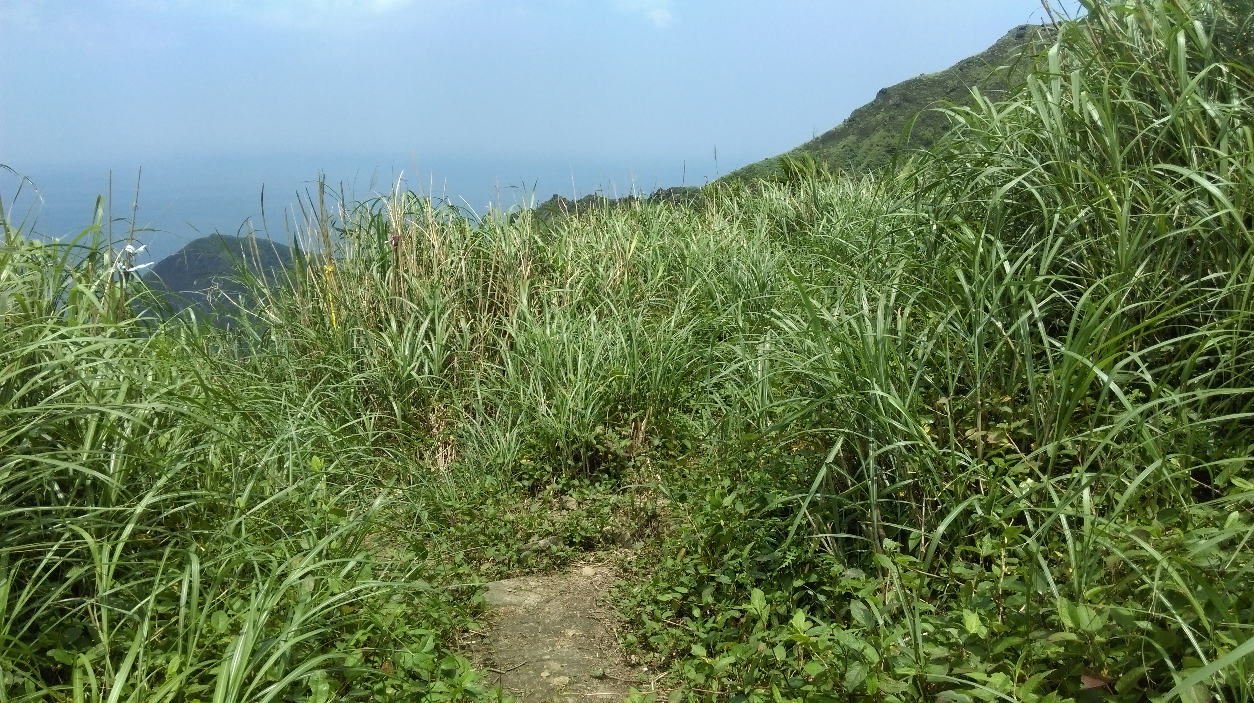
The mountains around Jinguashi are covered only by grasses. There is no shade on this hike, so be prepared and have plenty of fluids.
This trail is cleared periodically. The exact condition of the trail depends on when it was last cleared. If it is becoming overgrown the grasses and plants with thorns can cut legs. Long pants are recommended for this hike.
Difficulty Level: 3/5
The Hike
From the entrance keep following the main walkway through the Jinguashi Gold Park signposted for the Gold Museum. Along the way you’ll pass the visitor center and some Japanese era historical buildings. Around the post office there are several good places to eat lunch. Also, buy your water here before going any further.

entrance to the Gold Ecological Park
Continuing on the main walkway passes more Japanese era buildings then climbs up on stone steps. Keep going straight at a trail junction after the steps. The walkway goes past the Gold Museum then crosses a stream over a bridge in front of the museum.

near the Gold Museum
Continue with the main walkway as it goes along the hillside above the town.
walkway above the town
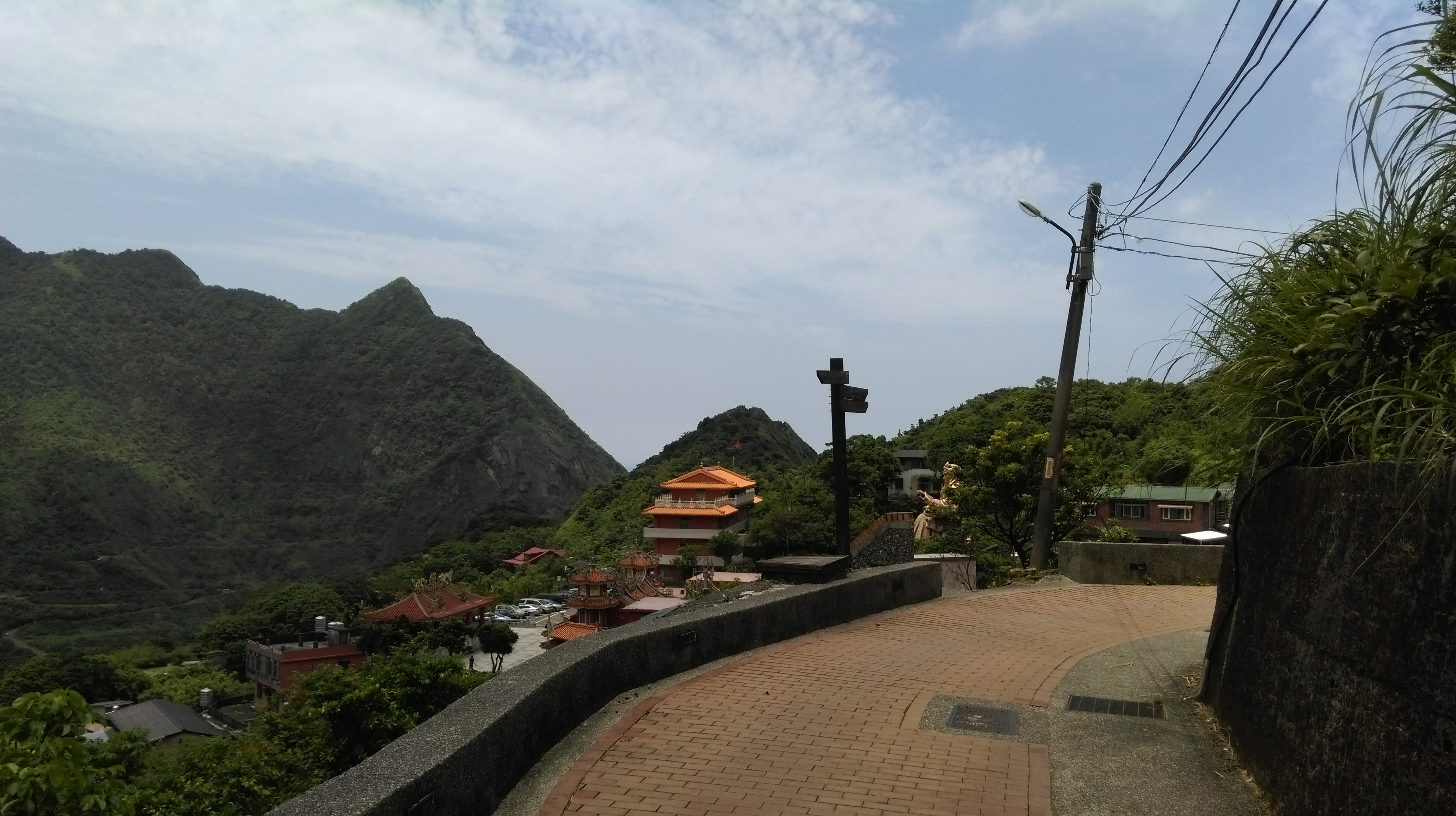
The walkway ends at a parking lot. Halfway through the parking lot there is a path going through a tunnel. On the other side of the tunnel you’ll come to a viewpoint.
viewpoint
From the viewpoint keep walking on the road, don’t take the stone steps. The trailhead is located a short distance up the road at a sharp turn. There are no signs marking the start of the trail.

walk up the road from the viewpoint

trail starts here
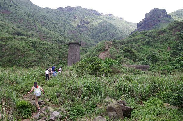
The trail heads into the grass and soon crosses over a couple of smokestacks.

crossing a couple of smokestacks
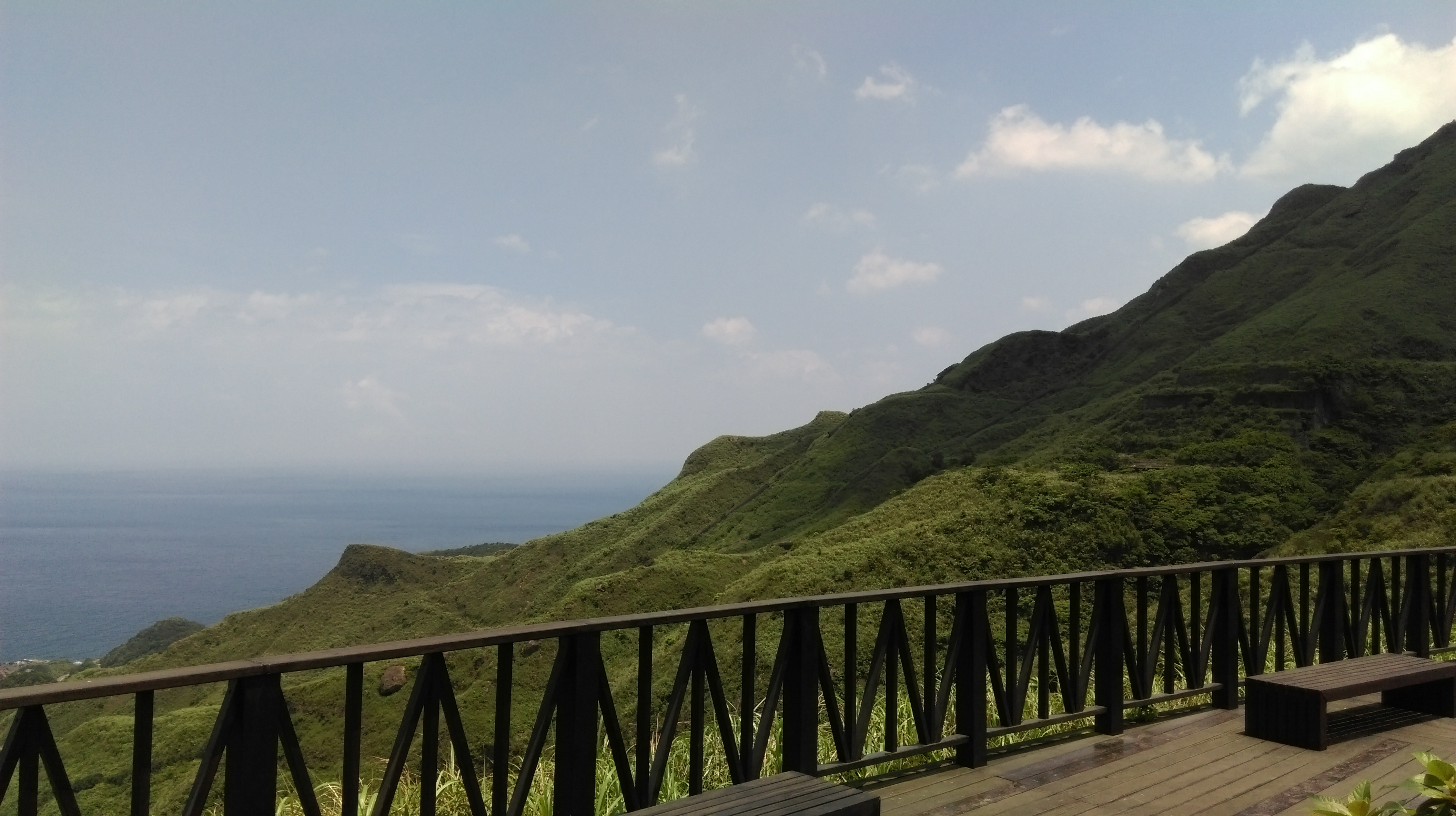
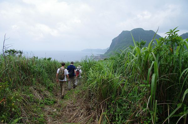
After this the trail contours the hillside with excellent views of the north coast all the way. The trail comes to another smoke, you have to climb through this one and climb down a few feet inside of it, there is a rope to hang onto.

trail along the hillside
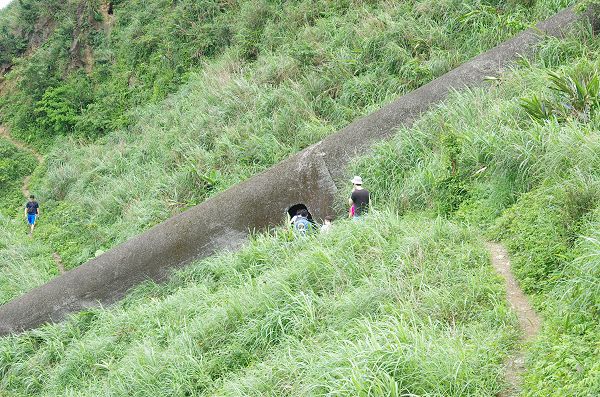
going through a smokestack
The large cement pipes you see on the hillside here are smokestacks. They were used to carry the pollution away from the smelter and expel it on the other side of the mountain away from the towns.
The trail continues to contour the mountain, passing through another broken smokestack, then going around to the other side of the mountain now heading away from the coast.

continuing along the hillside

broken smokestack

great views
Around the other side of the mountain the trail passes the outlet for the smokestacks. Fork left at a trail junction here.

going around the backside of Teapot
approaching the smokestacks’ outlet
Shortly afterwards the trail enters a gulley with some small trees and a tiny creek flowing through it. Fork left again at a trail junction in the trees.
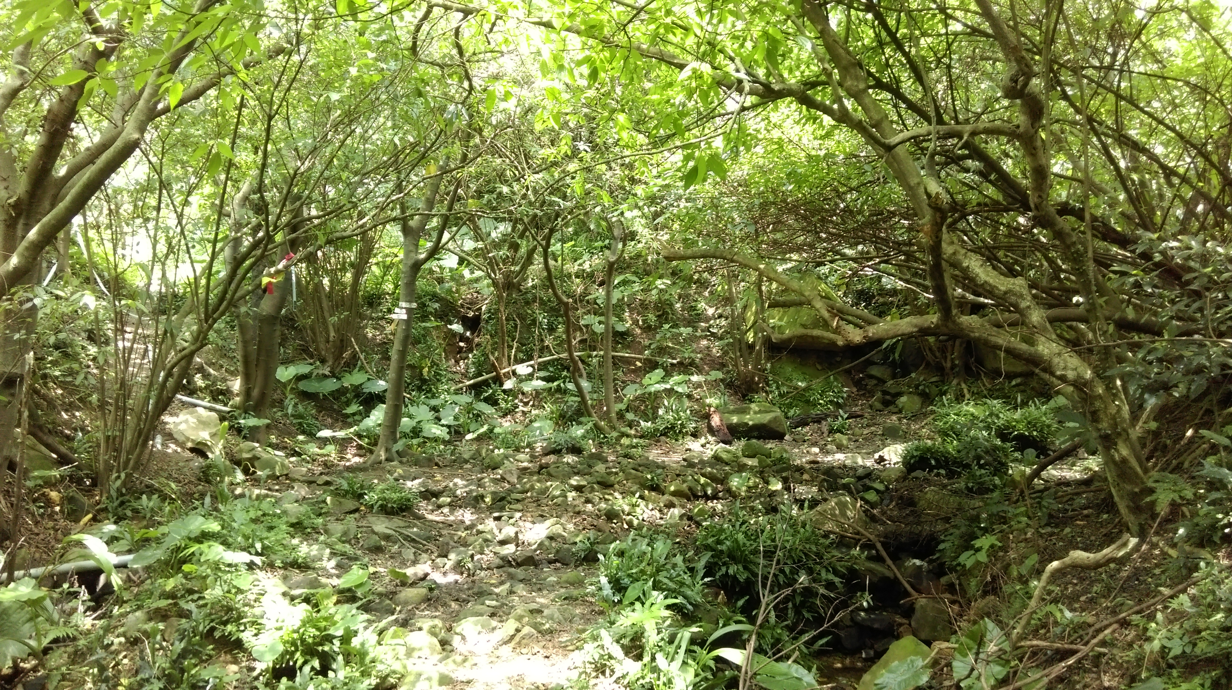
fork left in the trees
Emerging from the trees the trail continues along the hillside going towards the coast once again.

hiking away from Teapot towards the coast
Fork left yet again at another trail junction.
fork left here
From the junction the trail goes along the top of a small ridge going towards the coast.

trail going along the ridge
The trail crosses over the high point of the ridge then makes a short steep descent with the help of a rope.

short steep descent off the small peak
Continuing along the ridge and over another small peak, fork left once again at another trail junction.

continuing along the ridge
After the junction, the trail makes a short steep descent through some small trees.
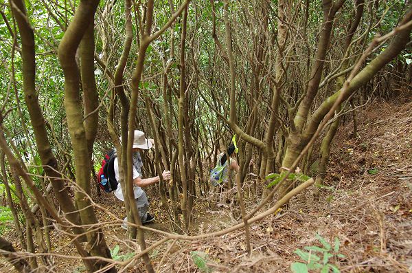
fork left and make the short steep descent through the trees
The trail now goes along a small valley between the ridges, soon going a tiny creek and crossing it multiple times. The grasses are at their thickest through here. Keep following the hiking flags marking the trail through here and ignore any trails branching off.
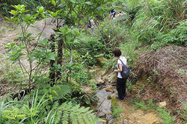
following the tiny creek
After a while the trail will make a short climb away from the stream, then going along the hillside and passing a large boulder.

climbing away from the creek

pass the boulder
After the boulder the trail soon reaches the Gold Pond.

Gold Pond
Turn left at the Gold Pond climbing up the boulders.

take this trail from the Gold Pond
The trail continues towards to coast and comes the some mining ruins.
hiking towards the highway
The trail swings around the ruins and descends to the highway.
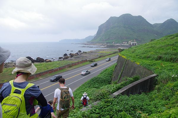
descending to the highway
Go left at the end of the trail, walking along the highway until you come the large parking lot below the 13-tiered smelter. There are public restrooms here.
From the parking lot cross the road and take the wooden trail climbing up above the stream on the other side. This short trail leads up to the village. Keep going straight taking the steps up through the village past the police station. Halfway up there is a viewpoint where you get a good view of the smelter, waterfall, and surrounding mountains.

take this trail across from the parking lot leading up to the village

viewpoint in the village
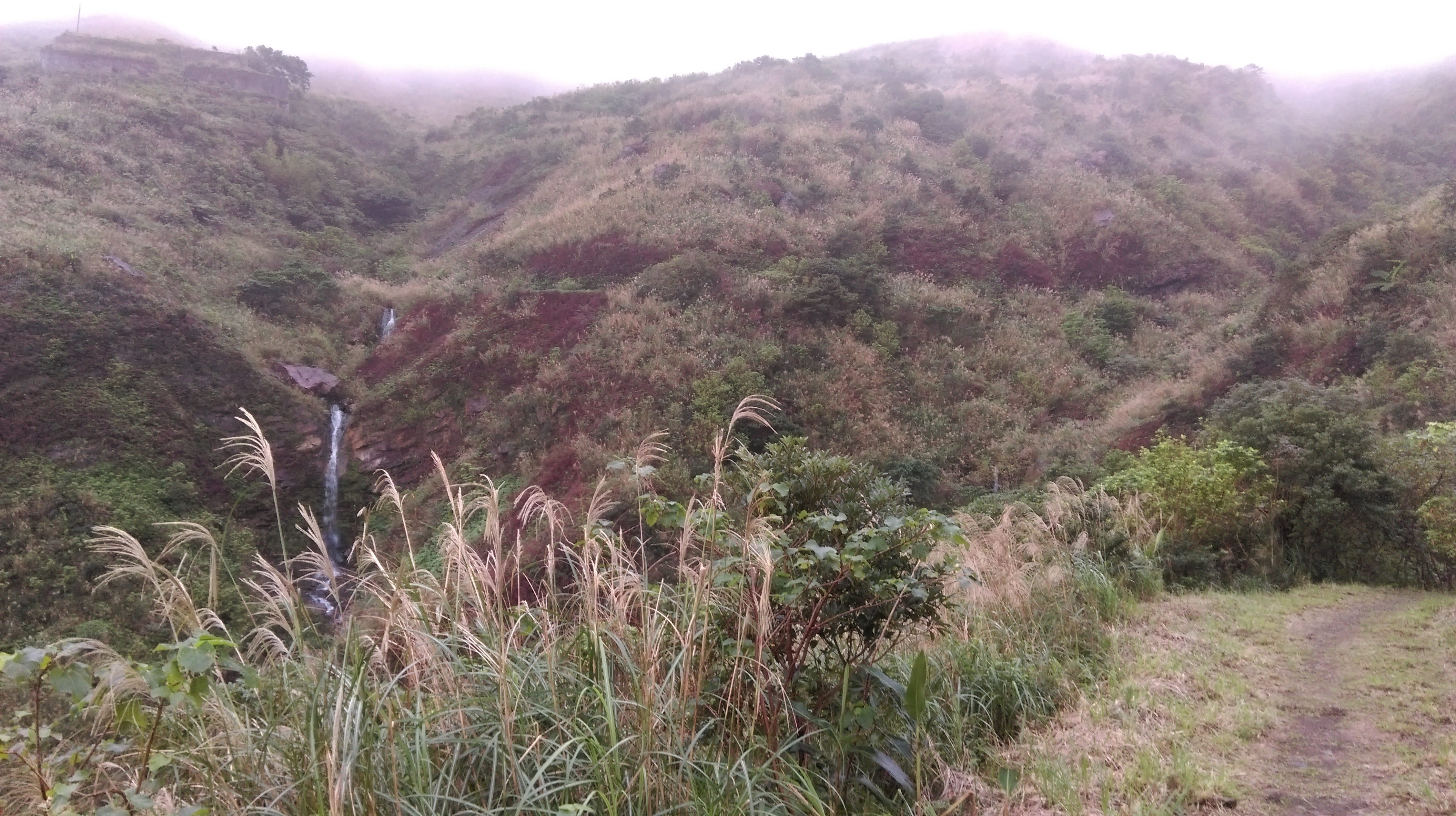
From the viewpoint walk along the roads up to the waterfall.

Huangjin Waterfall
__________________________________________________________________________________________________
UPDATE: the trail that goes between the waterfall and Jinguashi was closed off on my last visit here in May 2016, oddly only a few months after stairs and platforms were constructed along the trail to provide access to the top if the smokestacks. There was a new fence across the road and even a security guard standing there to prevent people from going around it. Clearly some people had gone around the fence as I could their footprints. I suspect the guard is not here on weekdays. Another problem is if the trail is not maintained it will quickly become overgrown and soon be impassible. This means the only way to get back up to Junguashi is to take a bus from the waterfall.
__________________________________________________________________________________________________
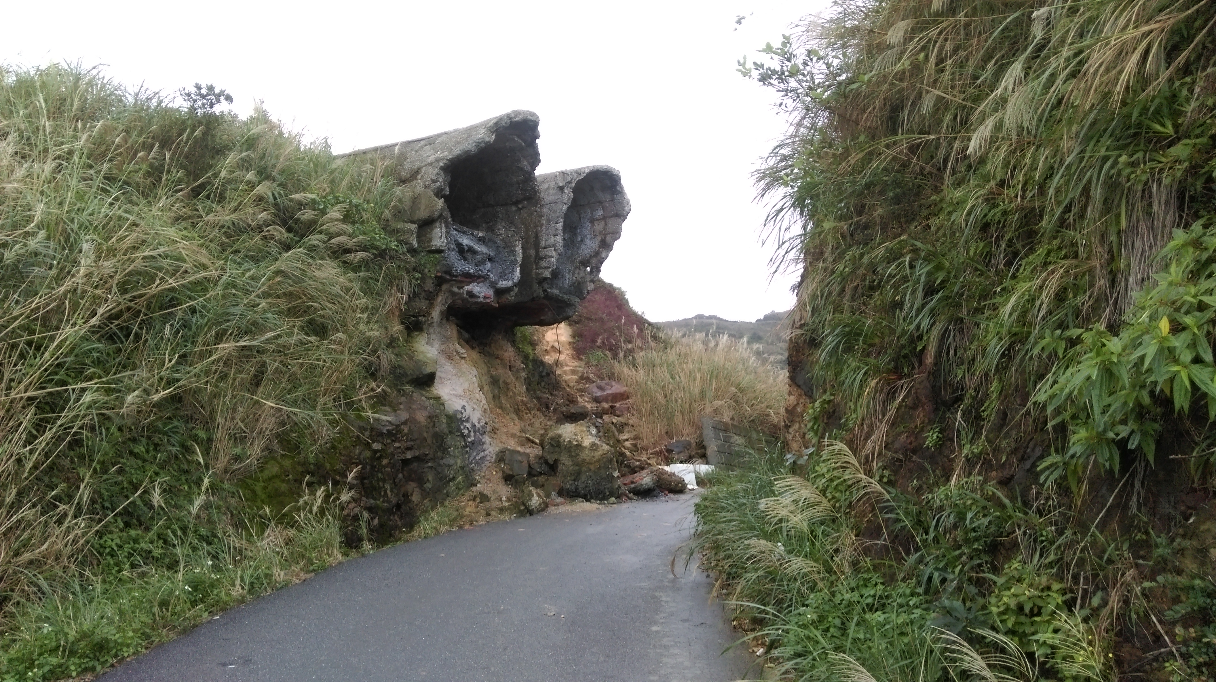
Turn left at the T-intersection at the waterfall, walking along the road as it goes above the smelter and around a couple of sharp turns. Then turn right at the next intersection. This smaller road continues to wind up and ends at a couple of smokestacks (this road is now blocked off by a fence).
mining ruins
The road here was taken out by a landslide years ago. Follow the path over the landslide and the road continues on the other side passing some mining ruins.

going over an old landslide
Follow the trail from the end of the road as it winds up the hillside and ends at the viewpoint at the tunnel.

mining ruins
trail going up to Jinguashi
Map of the Hike
