Teapot Mountain / Mount Banping / Mount Caiguangliao
Ruifang District, New Taipei City
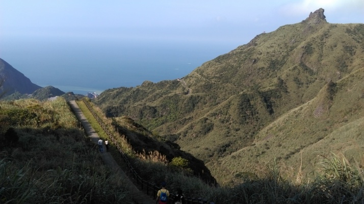
This is circular hike that goes over three peaks near Jinguahsi. The views are excellent through the entire hike.
Warning: 1) there is absolutely no shade anywhere on this hike. It is best to do this hike on a clear spring or fall day. It is very hot up here in summer and dehydration can be a serious and dangerous problem. It is also not a place you want to get caught on in a thunderstorm.
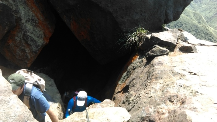
2) People have fallen to their deaths (and disappeared) in the cave on the top of Teapot Mountain. Areas of the cave are roped off for a reason and are best avoided. Wear proper hiking footwear and don’t climb if the rocks are wet. This is also not a hike that should be attempted alone.
Access: take the train to Ruifang Station, from there the best way to reach Jinguashi is by taxi. Taxis charge a flat rate of $240.
Length: 8km, 5 hours
Trail Conditions: mostly dirt trails with ropes and overgrown sections (gloves, long pants and maybe even long sleeves are recommended to avoid being cut by the overgrown grass), lots of steep steps at the start and end
Difficulty Level: 4/5
The Hike
From the entrance to the Gold Ecological Park, walk through the park along the main pathway leading to the Gold Museum. Along the way, there are several cafes and eateries near the post office where you can get lunch before starting the hike.
Follow the walkway past the Gold Museum and across the bridge over the stream.
Take the stairs leading up beside the stream just after the bridge. From here is a very tiring 90 minute climb to the top of Mount Banping.
The steps end at a road. Follow the road uphill, passing a pavilion along the way, to the start of the trail leading up to Teapot Mountain, signposted for CHA HU SHAN SUMMIT.
The trail climbing up Teapot Mountain is mostly very steep stone steps.
There is a viewpoint and a wooden pavilion along the way where you take a short rest and enjoy the excellent views.
After the pavilion it is a short steep dirt trail climb up the rocky summit of Teapot Mountain. There is also a warning sign in Chinese only.
There is a cave in the rocky peak that you have to climb through. Coming from this direction it can be confusing at first to figure out how to pass through the cave. Enter the cave and climb up onto the rock. Then turn right (don’t take the ropes straight ahead), climb down the rock and duck through the narrow opening.
Then climb up the ropes on the right.
At the top of the ropes, turn left and walk along the ledge (don’t take the footholds chiseled into the rock on the right).
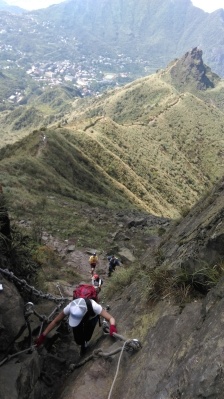
After walking on the ledge you’ll find the trail leading up to Mount Banping. From here is another long steep climb up the top, with lots of steep steps supported with wooden ties.
As you approach the cliff face ahead the trail will lead over the top of the heart shaped debris.
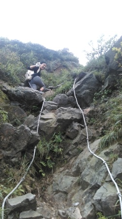
Climb up the ropes in the V-shaped cliff to reach the top. The ropes are not quite vertical and there are plenty of footholds, so it is a fairly easy climb up.
At the top the trail turns right and goes along the ledge with ropes that you can hang onto for support.
The trail then leads up the highest point of Mount Banping. The trail heads down the other side of the summit with good views of Mount Caiguangliao ahead.
The trail then enters a small gulley with a few trees and a dry creek bed.
After leaving the gulley there are a few more rocky parts and ropes before the trail becomes easy again. After passing another warning sign the trail with some wooden steps leads to a road at the end.
When you reach the road, turn left, walk a few meters, and take an unmarked trail leading upwards on the right hand side. This is the trail leading over the peak of Mount Caiguangliao. This is a very narrow and overgrown dirt trail but it is well travelled.
The trail climbs upward through the tall, thick grass.
Another rope climb up the rocks leads towards the mountain’s summit.
From the top of the ropes, the trail leads along a rocky, shrub and flower covered ridge to the summit. There are a few rocks and a small marker on the summit, and naturally more good views of the entire area.
From the peak the trail climbs down the other side through more shrubs with a few rocky scrambles and rope sections.
Closer the bottom the trail goes through more thick grass.
At the bottom of the trail there is a road and an ancient looking primitive village. This was still being worked on when we passed thorugh here, so I’m sure what they are planning to do with this.
Turn right and walk up the road to another road, then turn left. Walk along this road until you come to a stone trail on the right hand side, signposted for Penshan geopark. This stone trail leads back down to Jinguashi.
About halfway down you’ll come to a trail junction. Turn left here to reach the geopark, an old open mine pit.
After seeing the mine, return to the trail and keep going down to Jinguashi, passing some old ruined mining buidlings and the ruins of a Japanese Shinto shrine along the way.
Map of the Hike


