***THIS HIKE IS CURRENTLY IMPASSABLE DUE TO TYPHOON DAMAGE***
Happy Valley to Red River Gorge
Sanxia/Wulai Districts, New Taipei City
Introduction
This is fantastic forest emersion hike. The hike is spent going through thick forest with old, moss-covered, weather beaten trees. It is much different that what you see on hikes closer to Taipei. The hike starts by following a stream in Sanxia, climbing up over a peak, then down the other side following another stream to Wulai.
Access: to do this hike to you need to catch the 807 bus leaving Sanxia bus terminal at 8:30 on weekends and get off at the Xiongkong (熊空) stop near the end of the bus route. To reach Sanxia either take a bus or taxi from Yongning MRT Station.
Length: 17.5km about 6.5 hours
Difficulty Level: 4/5
Trail Conditions: narrow dirt trail for most the way (much of this hike is on a very narrow trail with a steep drop off to the river far below), some overgrown sections, short rope sections and steep climbs, several bridgeless stream crossings (depending on your height and the water level you may be in water up to your waist on the first three crossings. As the three get-wet stream crossings occur in quick succession you may want to bring a pair of sandals or a spare pair of shoes). Also, there are small sections where landslides have damaged the trail making for a few tricky spots.
The Hike
There is a small store on corner the at the bus stop, and public washrooms just down from the store behind a building with a fish sign on it. The store sells cold drinks, fruit, and not much else. They don’t have breakfasts here!
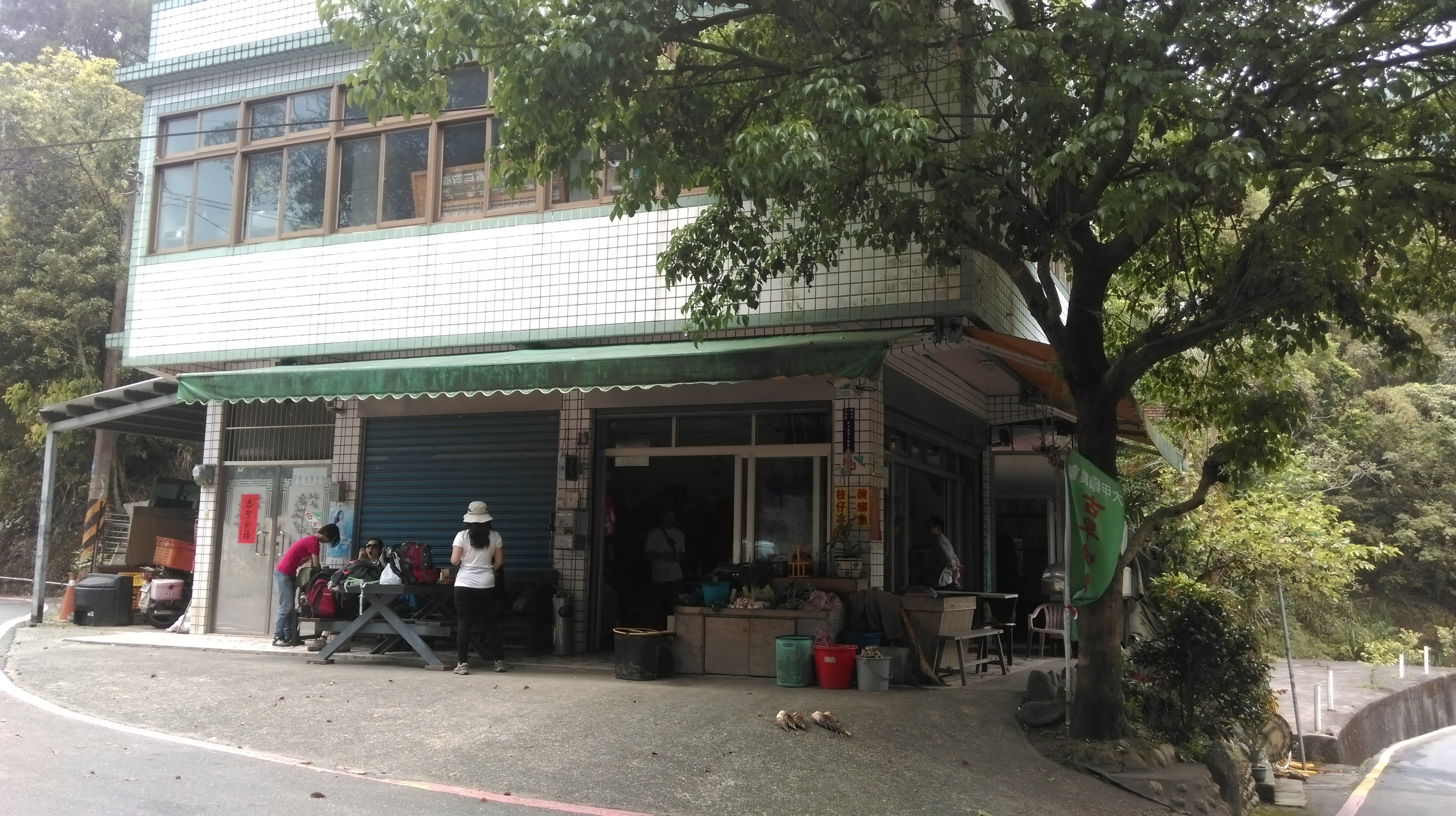
store at the bus stop in Xiongkong
From the bus stop turn right and follow the road upstream passing through tiny Xiongkong village.

walk up this road to reach the start of the trail

walking on the road
After about 20 minutes of road walking you’ll pass through another tiny village.

pass through the village
The trail starts on the right just after the village. There are no signs marking the start of the hike, only some flags attached to the trees.
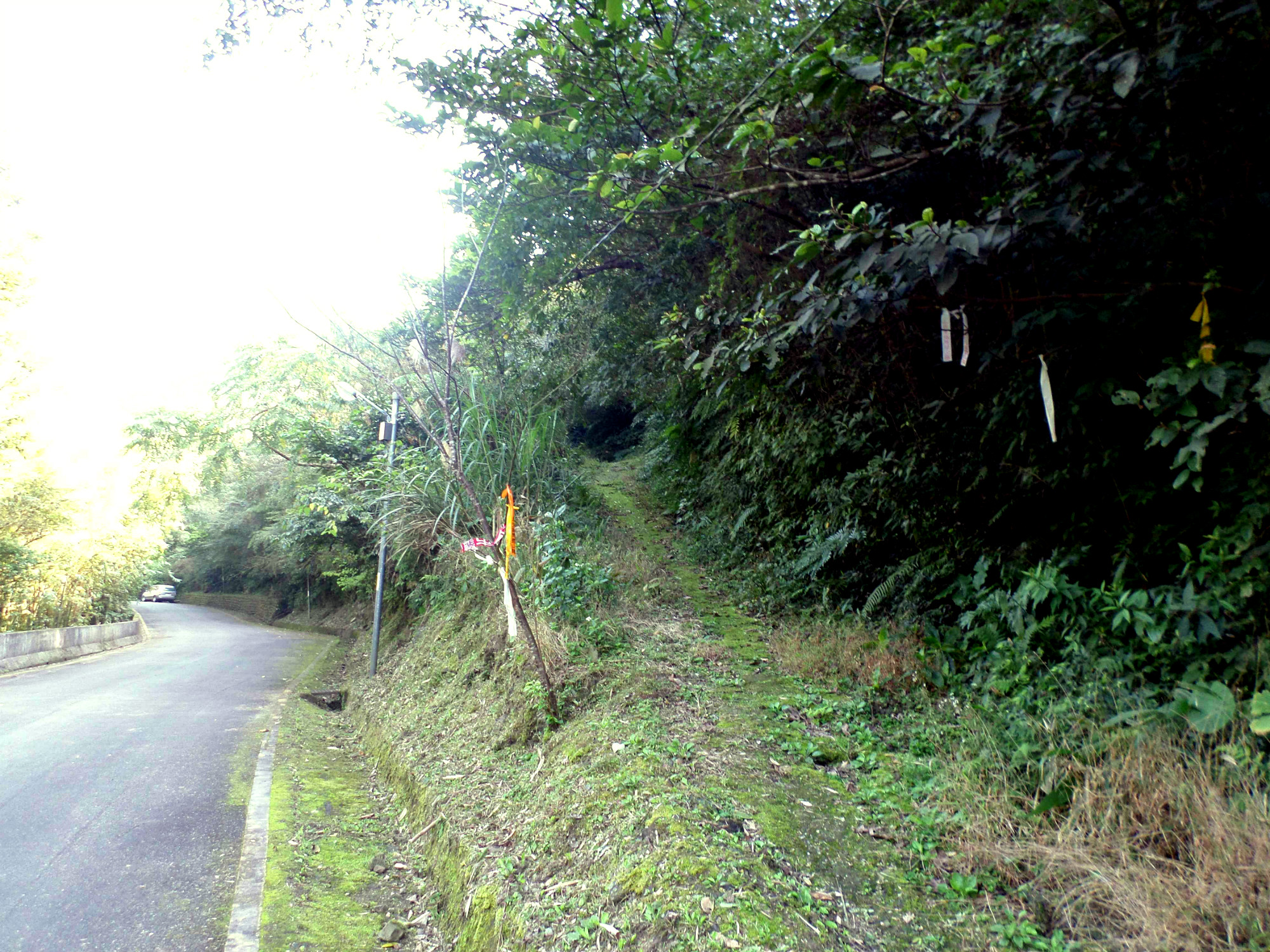
trail starts here after the village
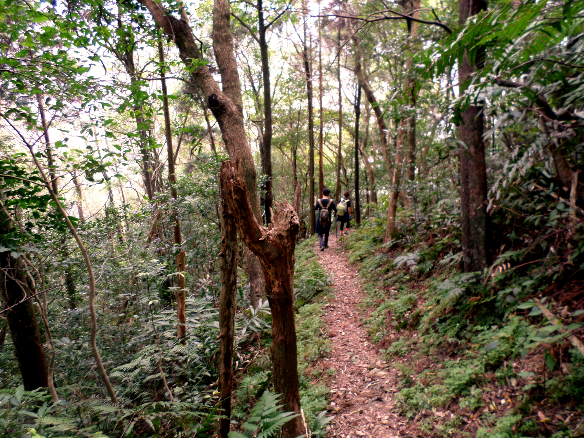
The hike starts easy enough with a flat trail following the stream and crossing several small tributary streams.

a nice easy start

crossing a landslide

small tributary stream

crossing small tributary streams
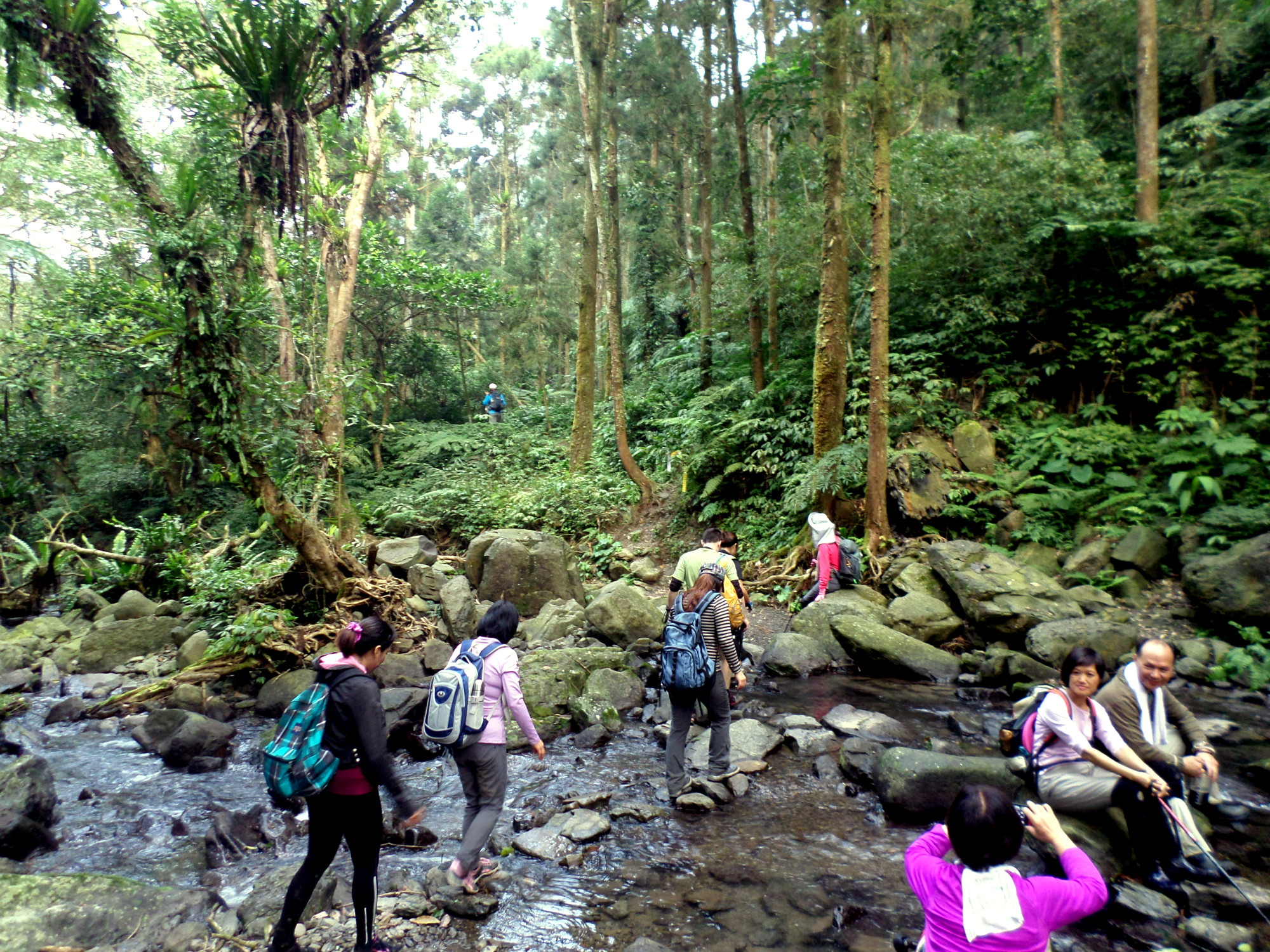
After about a kilometer of easy hiking you’ll encounter the first two bridgeless stream crossings. You will have to get wet here. Follow the hiking flags as the trail crosses the stream to the left bank, goes upstream on the left bank for a short distance, then crosses again to the right bank. Use the rope to help you make this crossing. The stream is at its deepest here.

first major stream crossing
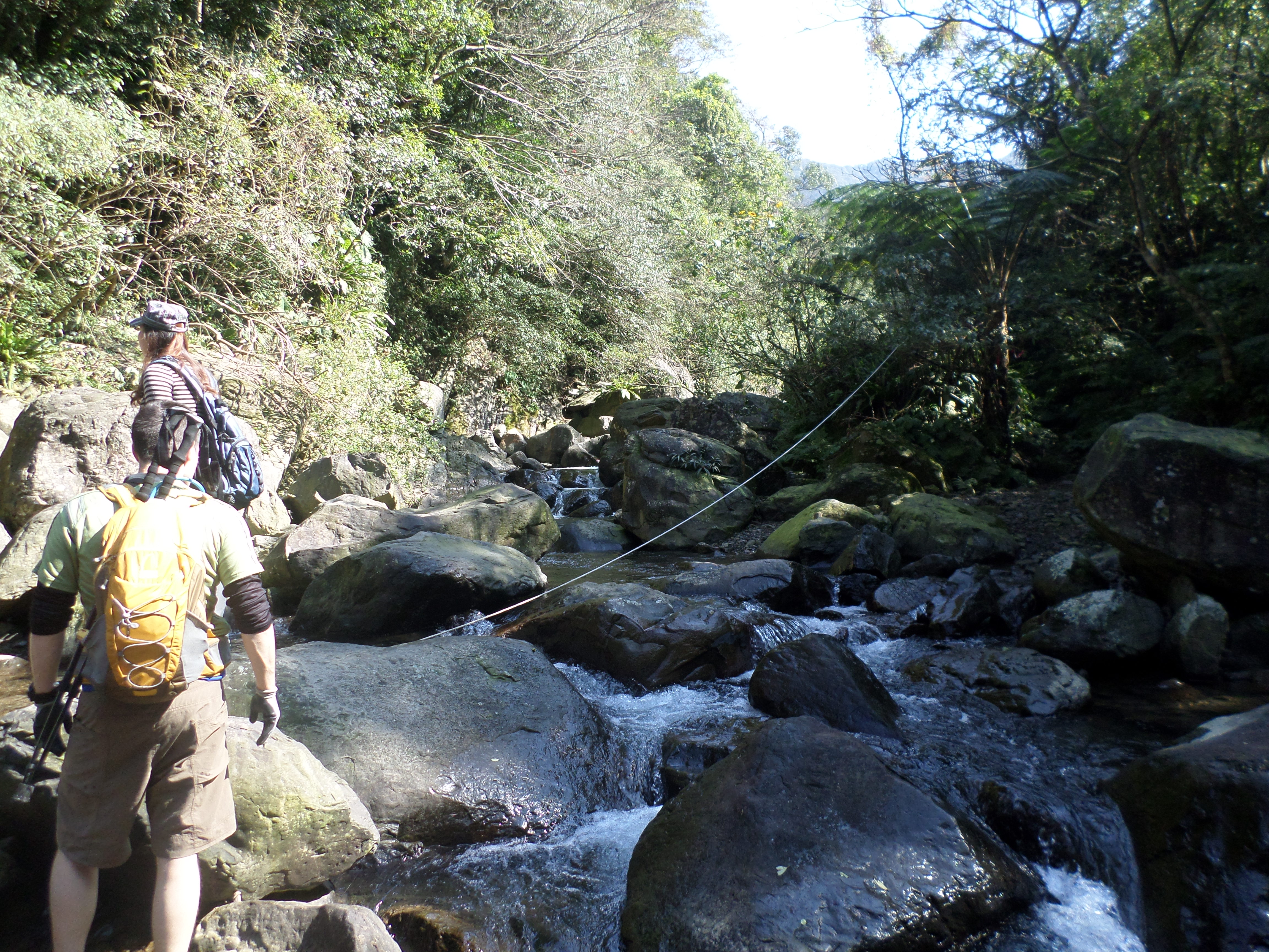
second major stream crossing
After this second crossing the trail follows the stream again on the right bank before soon crossing the stream for a third time. This is the last of the difficult, get wet crossings. Follow the flags here as the trail goes over some rocks then across the stream.
follow the flags over the rocks

third major stream crossing
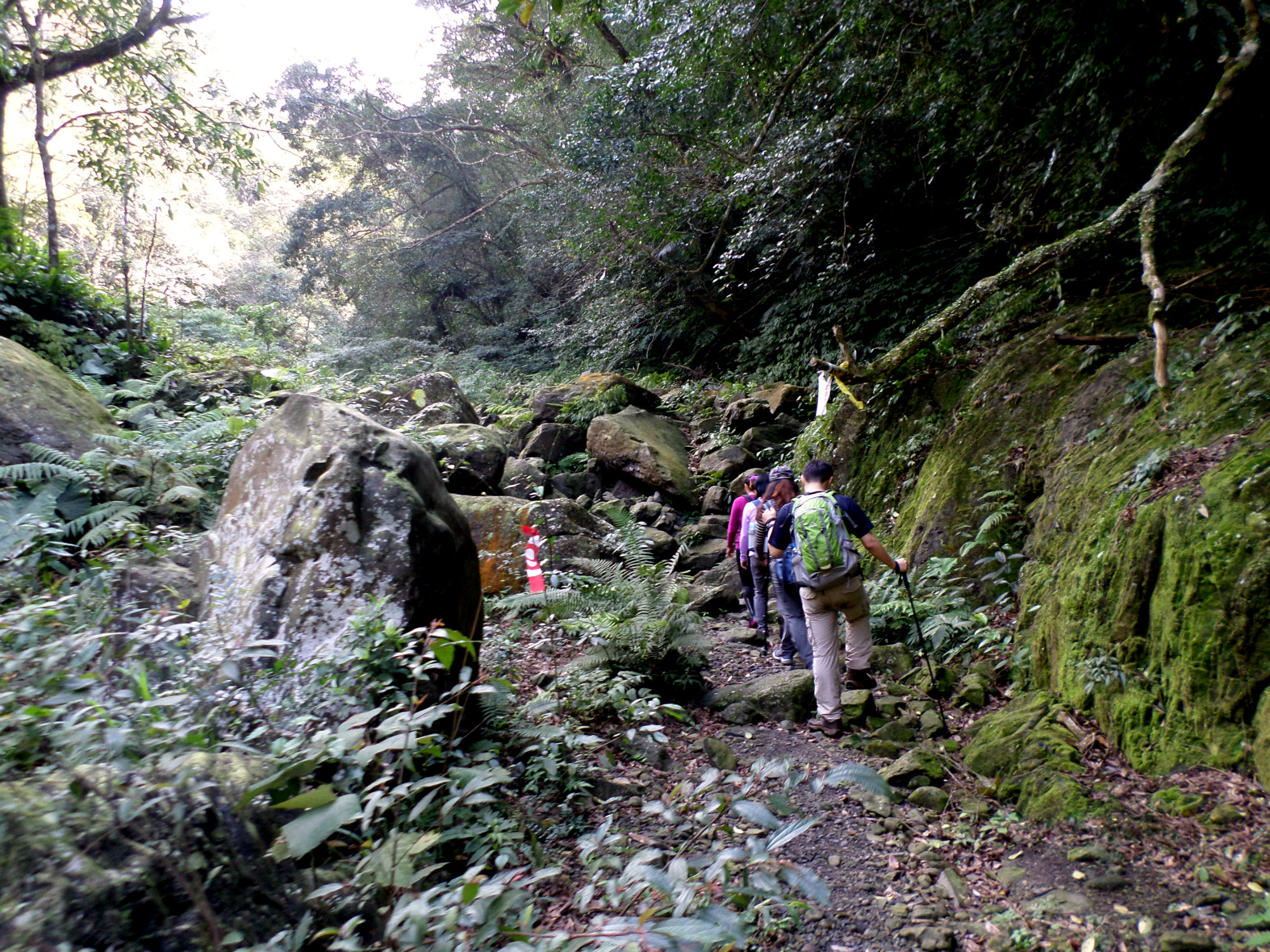
After the third crossing the trail climbs up away from the stream. The trail is rather overgrown in this section. After climbing the trail crosses another tributary stream. Take the right fork at a trail junction after the crossing.

climbing away from the stream

narrow trail

small stream crossing

take the right fork here
Keep following the flags as the trail makes two more stream crossings. After the last crossing the trail follows the stream downriver for a short distance then zigzags, climbing high away from the stream.

last crossing

climbing high away from the stream
After the long climb turn left at a small clearing, heavily marked by flags. After the turn the trail is much wider and climbs gradually towards the highest point, becoming more narrow and steeper again as you near the summit.

go left here

an easy section of trail

climbing towards the summit

resting on the summit
There is a large clearing at the trail’s highest point, as well as a trail junction. Take the trail going down on the opposite side of the clearing from where you came up. The trail descends steeply, sometimes with the aid of ropes, and the trail is covered with small stones making it rather slippery. The trail then levels off and descends more gradually (but with steep drop-offs), after a while zigzagging downward to where two small streams meet at the bottom. The trail crosses both streams.

steep, tricky descent

be careful here
flat section, but with steep drop-offs

going down to the streams below

stream crossing at the bottom

small stream crossing
Follow the flags as the trail crosses several small streams before reaching a larger stream. Your feet may get wet again at this crossing depending on how well you manage the slippery rocks.

Duck!

another stream

Love the forest!

stream crossing, careful on the slippery rocks!
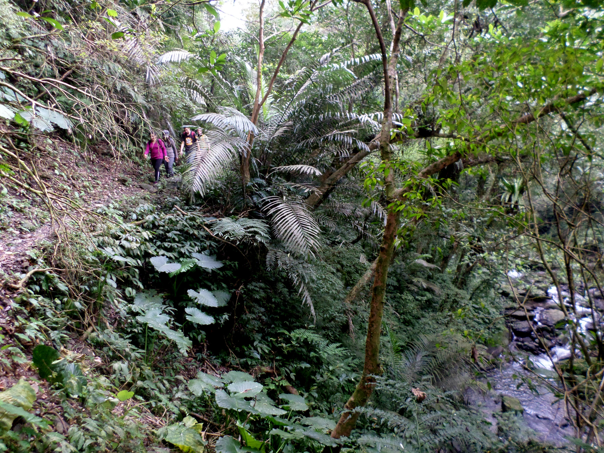
After the crossing, the trail follows the stream high above on the right bank. The trail will then descend to river level again and cross the wide Jiajiuliao Stream. You can use the stones here to cross without getting wet.

following the stream

crossing a small landslide

following high above the stream
last bridgeless crossing
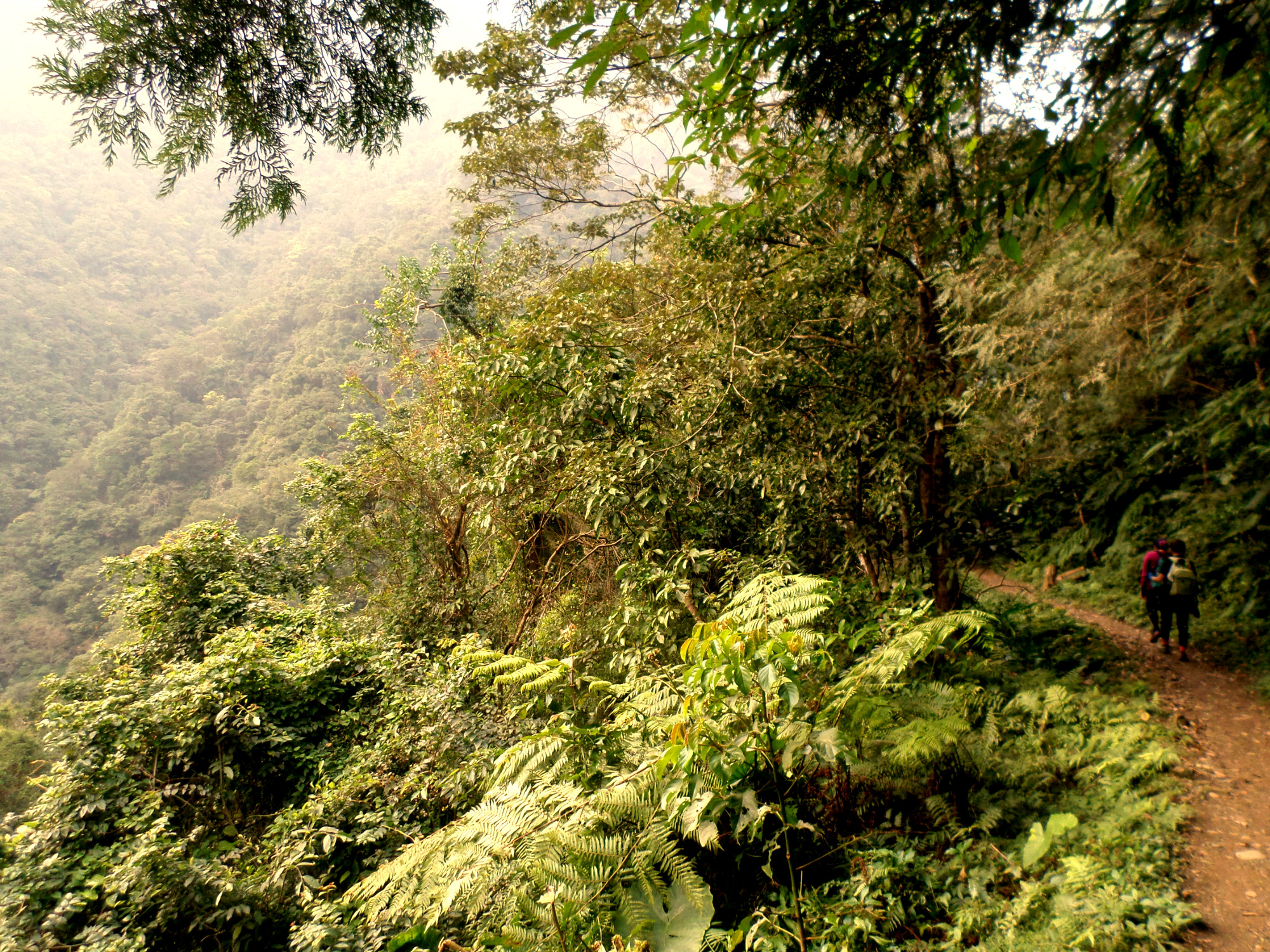
After the crossing, the trail follows the stream high on the right bank again. The trail will cross several tributary streams over log, wooden, and metal bridges.
following the stream

bridge over a small tributary stream

steep drop-offs

another bridge

more steep drop-offs

another bridge

rest area
After about four bridge crossing you’ll come the a small rest area with a bench to rest on. There is a nice view from the rest area. From the rest area take the left fork heading down. The trail will cross a couple of more tributary streams over bridges then arrive at a small shrine in the rock face with another rest area.

bridge crossing

small shrine
Soon after the shrine the trail descends with wood supported steps, zigzagging downwards to meet at concrete path at the bottom beside the stream. Follow the concrete path downstream and the trail will end where a road crosses the stream. Turn right at the road, follow it through the village and across the red arch bridge. The road then climbs up to reach the main road between Xindian and Wulai.
almost at the end of the trail

steps going down

paved trail at the end

red arch bridge
Map of the Hike
